Logical Diagram
| Target Namespace | http://xml.fmi.fi/namespace/meteorology/conceptual-model/meteorological-objects/2009/02 |
|---|---|
| Version | 0.5 |
| Element and Attribute Namespaces |
|
| Schema Composition |
|
| Documentation |
This document describes the basic meteorological Conceptual Model objects (a.k.a Meteorological Objects) used at Finnish Meteorological Institute as GML 3.1.1 Features. The concrete objects and properties are described in separate schema files. For detailed info see documentation Author: Ilkka Rinne / FMI 2009. |
| Prefix | Namespace |
|---|---|
| xml | http://www.w3.org/XML/1998/namespace |
| metobj | http://xml.fmi.fi/namespace/meteorology/conceptual-model/meteorological-objects/2009/02 |
| xs | http://www.w3.org/2001/XMLSchema |
| gml | http://www.opengis.net/gml |
| xsi | http://www.w3.org/2001/XMLSchema-instance |
| html | http://www.w3.org/1999/xhtml |
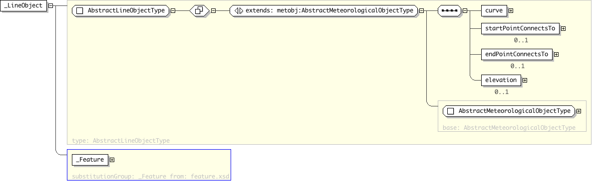
| Name | _LineObject |
|---|---|
| Type | metobj:AbstractLineObjectType |
| Nillable | no |
| Abstract | yes |
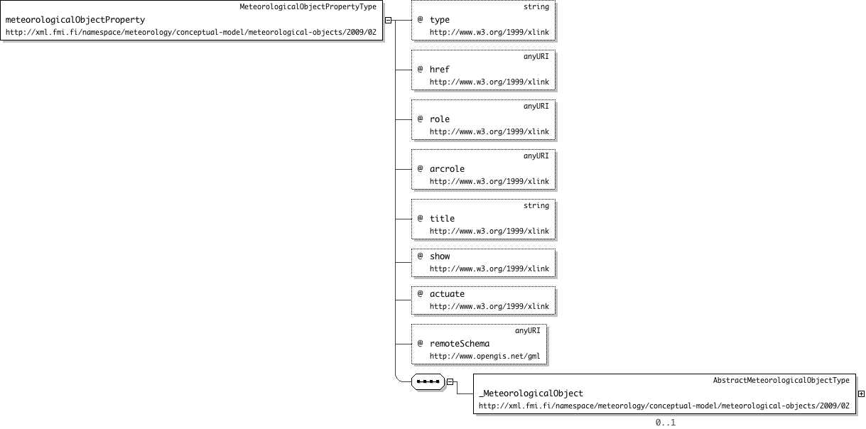
| Name | _MeteorologicalObject |
|---|---|
| Used by (from the same schema document) | Complex Type MeteorologicalObjectPropertyType |
| Type | metobj:AbstractMeteorologicalObjectType |
| Nillable | no |
| Abstract | yes |
| Name | _MeteorologicalObjectCollection |
|---|---|
| Type | metobj:AbstractMeteorologicalObjectCollectionType |
| Nillable | no |
| Abstract | yes |
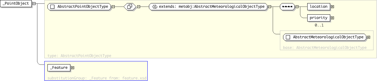
| Name | _PointObject |
|---|---|
| Type | metobj:AbstractPointObjectType |
| Nillable | no |
| Abstract | yes |
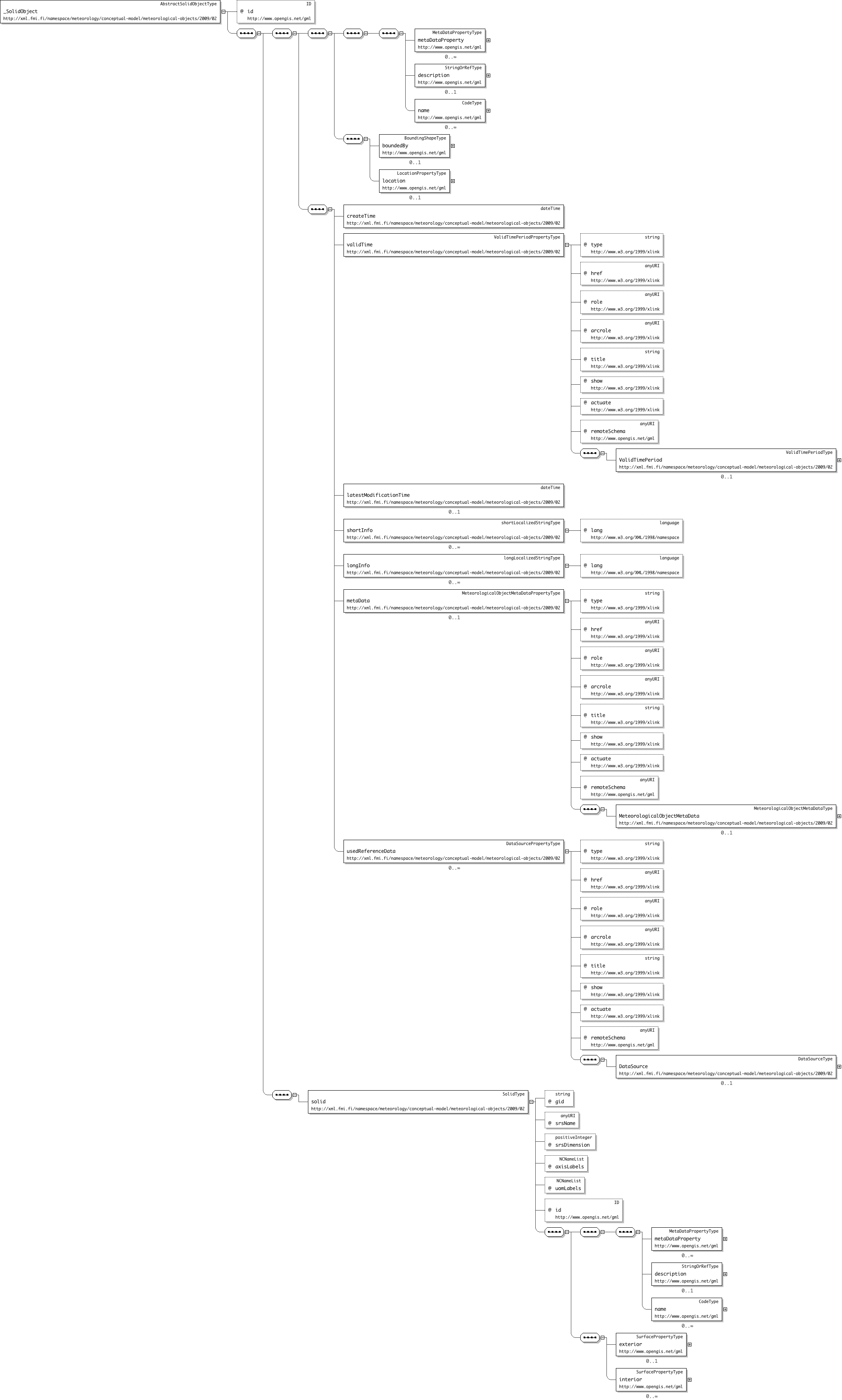
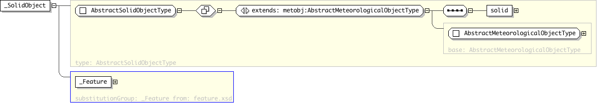
| Name | _SolidObject |
|---|---|
| Type | metobj:AbstractSolidObjectType |
| Nillable | no |
| Abstract | yes |
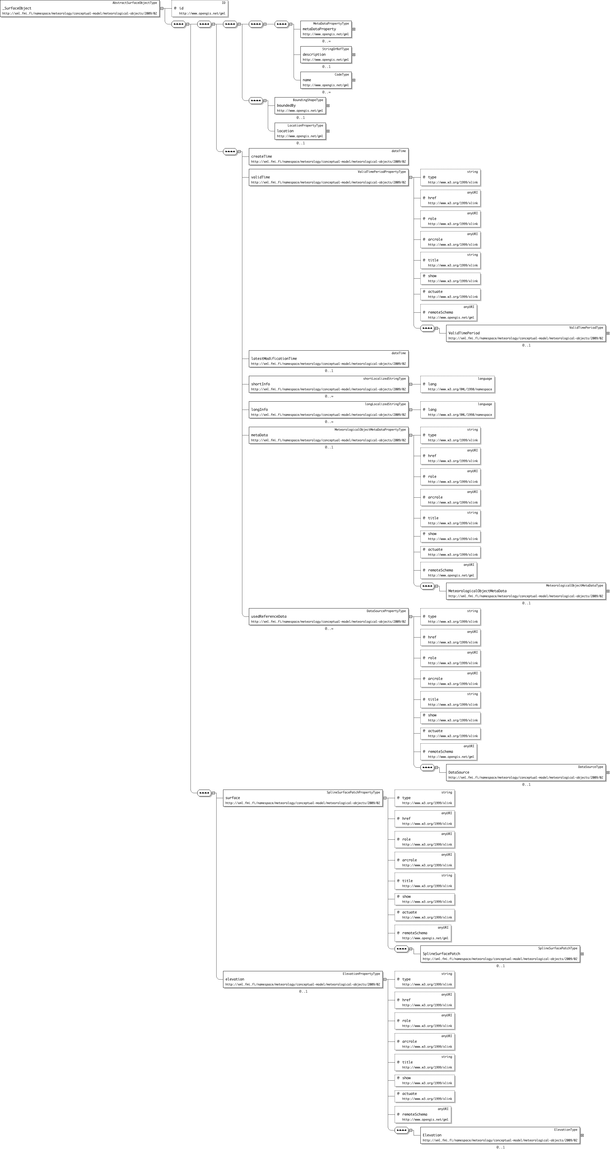
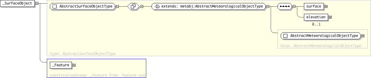
| Name | _SurfaceObject |
|---|---|
| Type | metobj:AbstractSurfaceObjectType |
| Nillable | no |
| Abstract | yes |
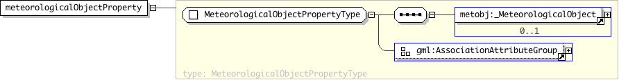
| Name | meteorologicalObjectProperty |
|---|---|
| Type | metobj:MeteorologicalObjectPropertyType |
| Nillable | no |
| Abstract | no |
| Super-types: | gml:AbstractFeatureType < AbstractMeteorologicalObjectType (by extension) < AbstractLineObjectType (by extension) |
|---|---|
| Sub-types: | None |
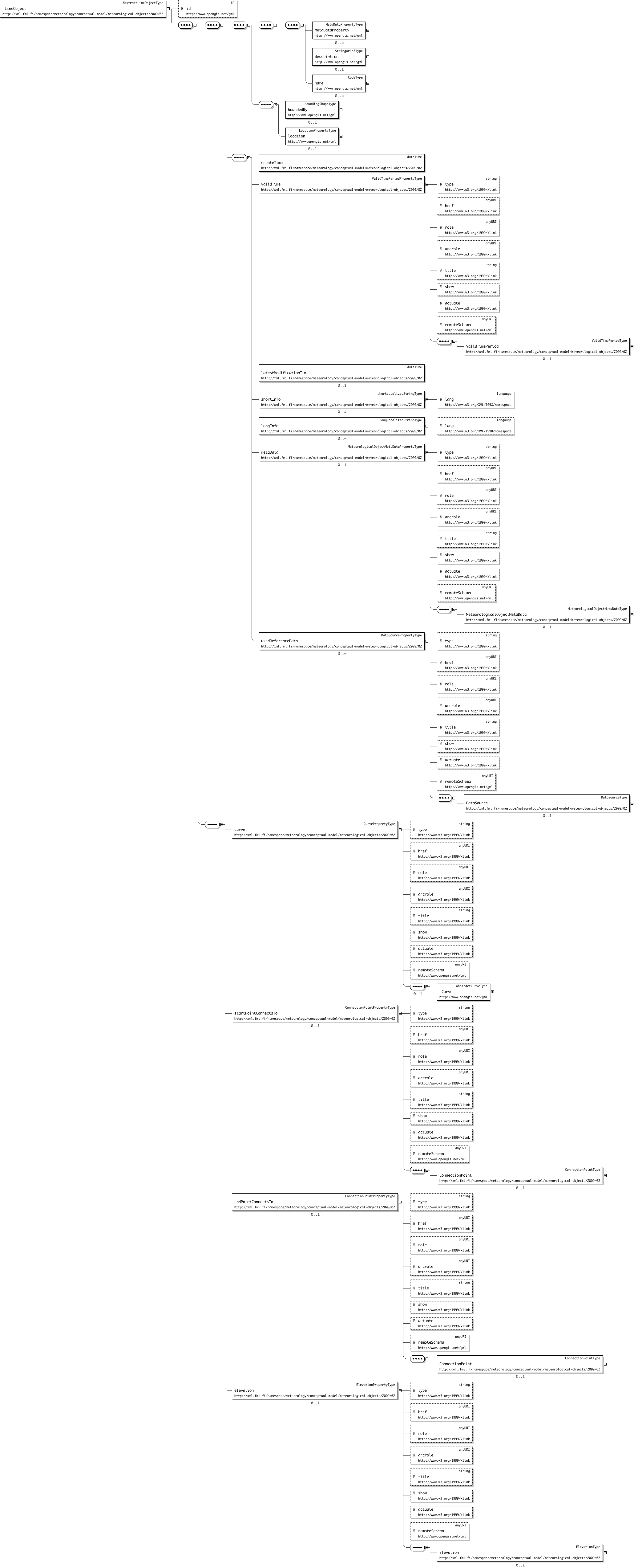
| Name | AbstractLineObjectType |
|---|---|
| Used by (from the same schema document) | Element _LineObject |
| Abstract | yes |
| Documentation |
Abstract parent type for Met Objects defined by one or more line segments between an ordered set of geospatial points. To be exact the line objects consist on one or more consecutive line segments so that the last point of the first segment must always have the same coordinates as the first point of the second segment and so on. If the coordinate values of these consecutive segments end points are different, the first coordinate point of the latter segment (in orientation order) must be ignored and be replaced with the last point of the former segment. Each line segment may be any element substitutable to gml:_CurveSegment, like
The points defined in each the given line segments should be considered as one consecutive array of geospatial points. If there are more that one segment, the first point (in the orientation order) of each of the segments following the first one is ignored (the first and the last point coordinates must always represent the same point). This is especially important when interpreting pointConnections indexes (see below). The segment type only affects the rendering of each segment. The orientation of the line is always positive, starting from the first position in the position list and ending to the last position. This may or may not affect the semantics and the rendering of the line object (depending on whether the concrete types have direction or not). If elevation property is given, its value must be added to possible height value of each of the points in the each line segment. If the CRS of the points is 2-dimensional, the value of the elevation should be interpreted as the static height value of each of the given (control)points. |
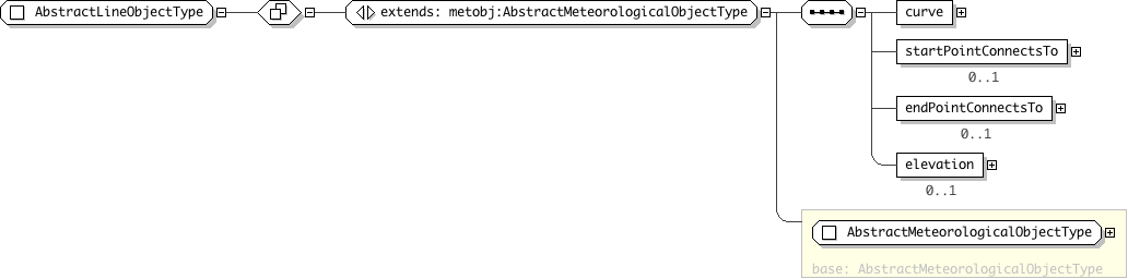
| Super-types: | gml:AbstractFeatureType < AbstractMeteorologicalObjectType (by extension) < AbstractMeteorologicalObjectCollectionType (by extension) |
|---|---|
| Sub-types: | None |
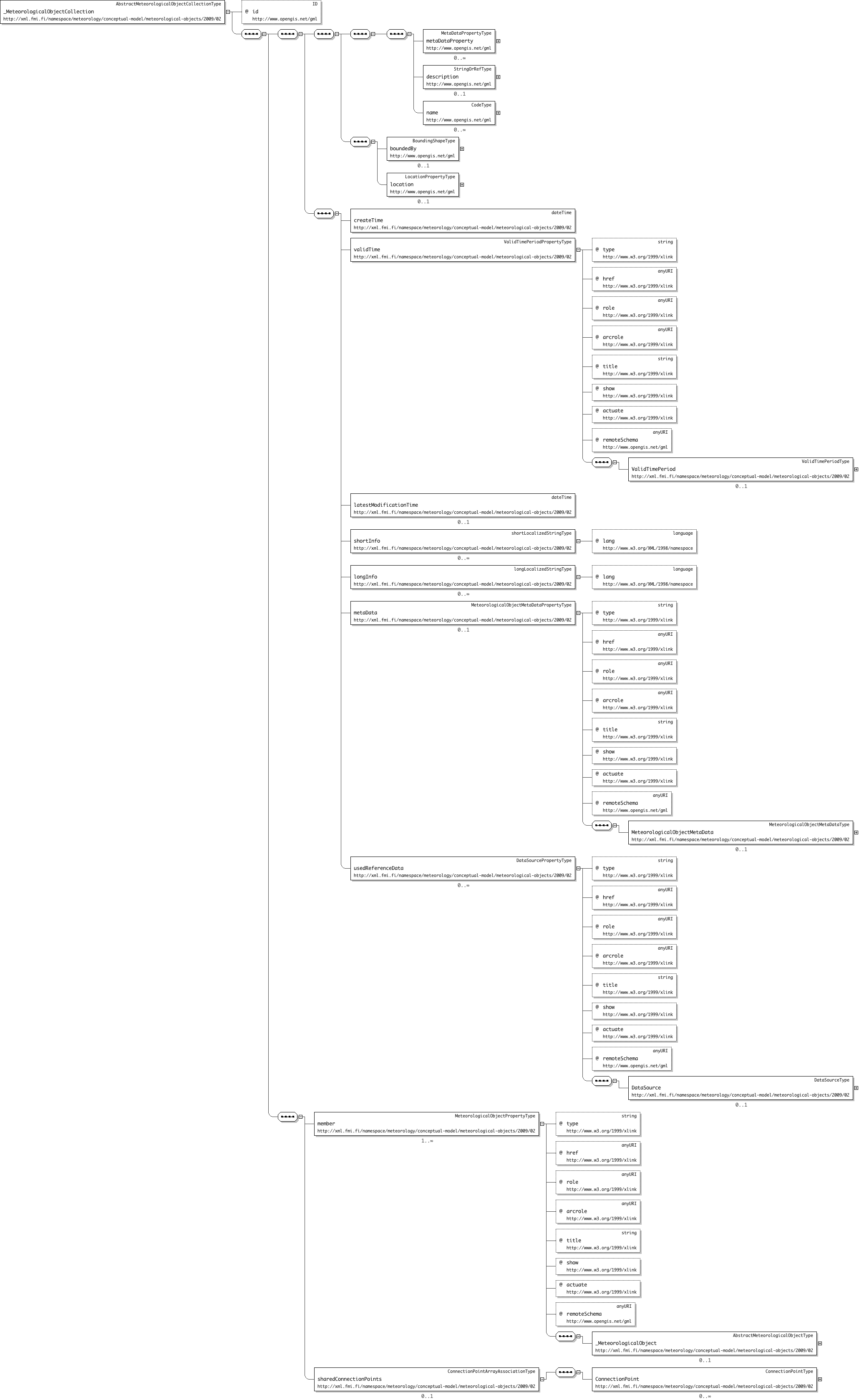
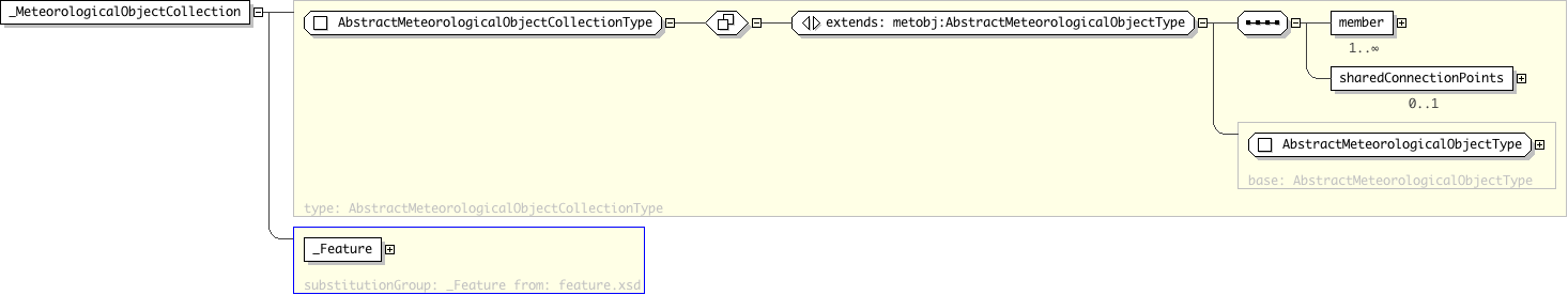
| Name | AbstractMeteorologicalObjectCollectionType |
|---|---|
| Used by (from the same schema document) | Element _MeteorologicalObjectCollection |
| Abstract | yes |
| Documentation | Abstract parent type for collections of Met Objects. |
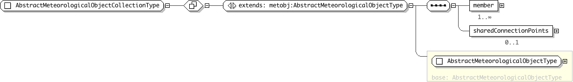
| Super-types: | gml:AbstractFeatureType < AbstractMeteorologicalObjectType (by extension) |
|---|---|
| Sub-types: |
|
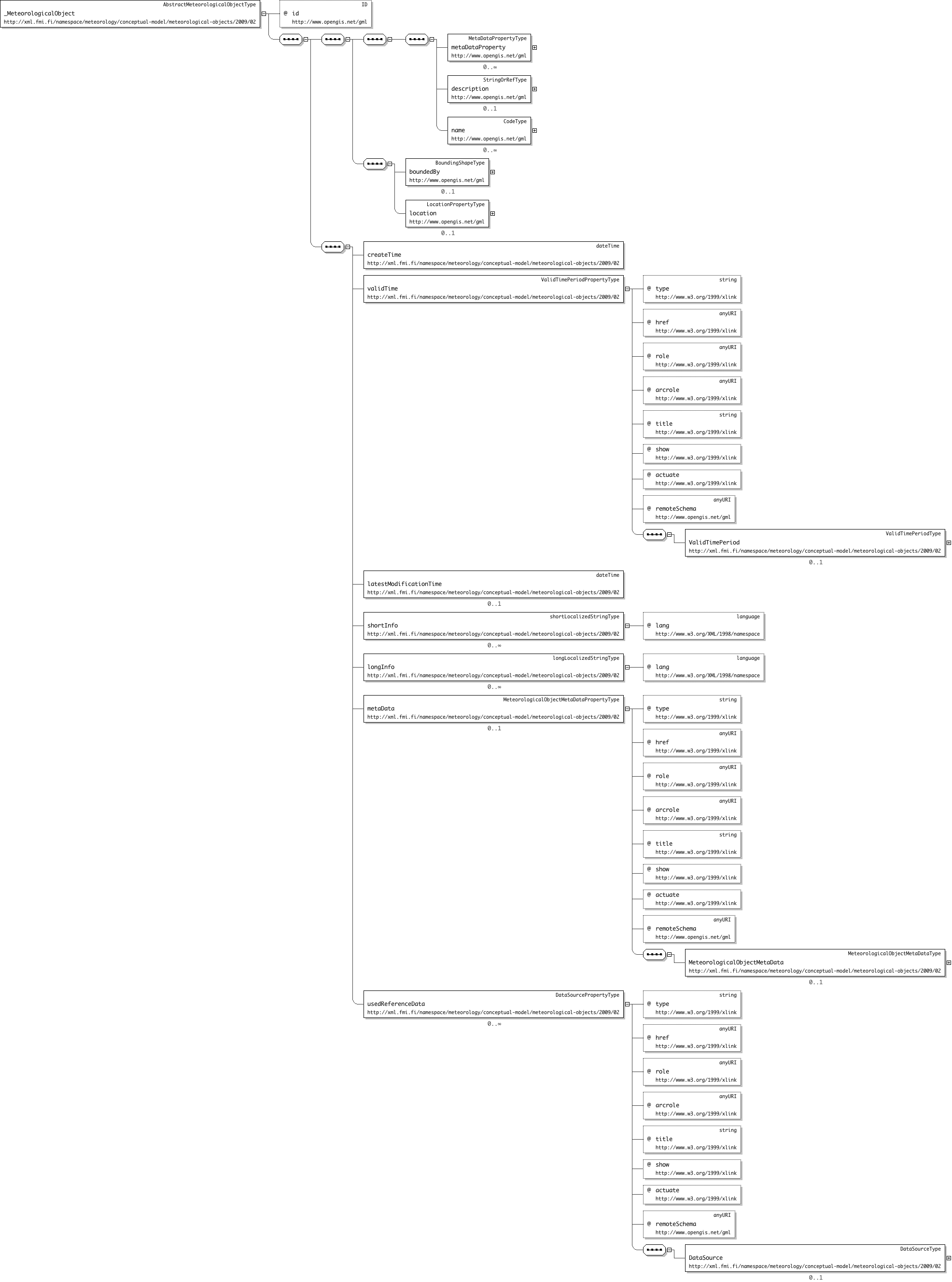
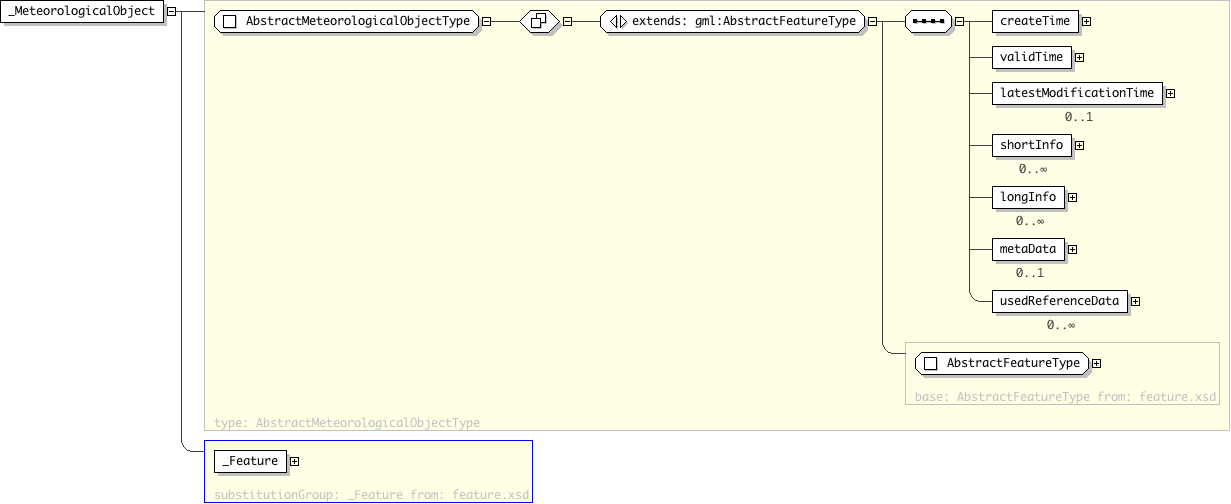
| Name | AbstractMeteorologicalObjectType |
|---|---|
| Used by (from the same schema document) | Element _MeteorologicalObject |
| Abstract | yes |
| Documentation | Abstract parent type for all Meteorological Objects. |
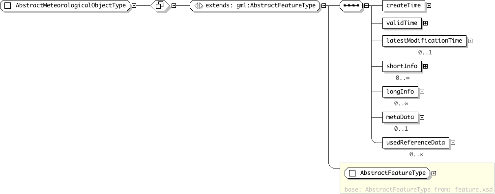
| Super-types: | gml:AbstractFeatureType < AbstractMeteorologicalObjectType (by extension) < AbstractPointObjectType (by extension) |
|---|---|
| Sub-types: | None |
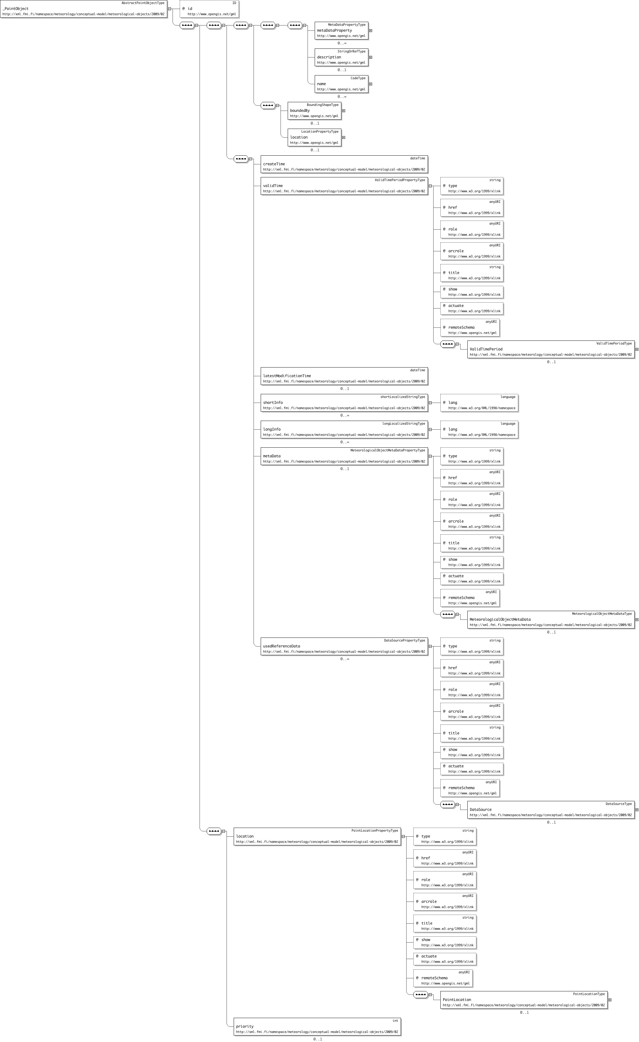
| Name | AbstractPointObjectType |
|---|---|
| Used by (from the same schema document) | Element _PointObject |
| Abstract | yes |
| Documentation | Abstract parent type for all Met Objects located at a single geosaptial point or point-like location (airport, city, observation station,..). Moving point objects can be modeled using DynamicMeteorologicalObject with multiple point objects as collection content. Mutual display priority levels of point-like objects can be given with displayPriority property: The rendering engine should start dropping the objects out in descending priority order if it cannot properly position all the point objects into the given display size using the given preferredRenderingSize (the ones with lowest numeric priority value will remain visible last). |
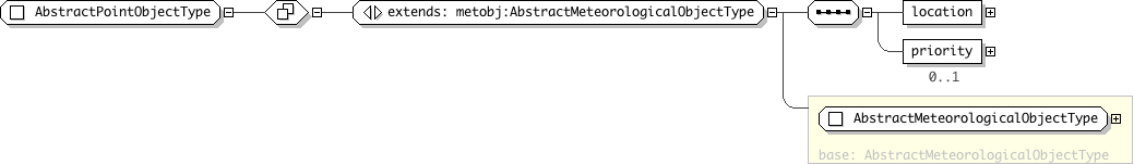
| Super-types: | gml:AbstractFeatureType < AbstractMeteorologicalObjectType (by extension) < AbstractSolidObjectType (by extension) |
|---|---|
| Sub-types: | None |
| Name | AbstractSolidObjectType |
|---|---|
| Used by (from the same schema document) | Element _SolidObject |
| Abstract | no |
| Documentation | Abstract parent object for solids ("3D volumes"). |

| Super-types: | gml:AbstractFeatureType < AbstractMeteorologicalObjectType (by extension) < AbstractSurfaceObjectType (by extension) |
|---|---|
| Sub-types: | None |
| Name | AbstractSurfaceObjectType |
|---|---|
| Used by (from the same schema document) | Element _SurfaceObject |
| Abstract | no |
| Documentation |
An abstract parent type for met object covering a continuous portion of a surface (surface patch). The surface can be an abstraction of a portion of ground (like rain or cloud area) or an elevated surface at some level above ground. The target area is defined by element "surface" containing one exterior ring (closed route through n coordinate points) and zero or more interior rings defining excluded areas ("holes") inside the exterior. type of the interpolation between the surface points can be specified by using attribute "interpolation". If elevation property is given, its value must be added to possible height value of each of the points in the each line segment. If the CRS of the points is 2-dimensional, the value of the elevation should be interpreted as the static height value of each of the given (control)points. |
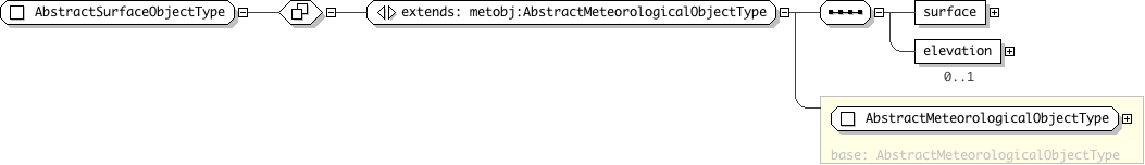
| Super-types: | None |
|---|---|
| Sub-types: | None |
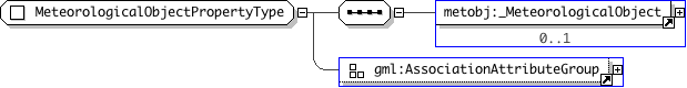
| Name | MeteorologicalObjectPropertyType |
|---|---|
| Used by (from the same schema document) | Element meteorologicalObjectProperty , Complex Type AbstractMeteorologicalObjectCollectionType |
| Abstract | no |
| Documentation | To be used when using this object type as property of n GML object type according to the GML object-property-association model (it is not allowed for GML Objects to contain other GML Objects as direct children). Enables referencing to an existing object using xlink:href attribute. |