| Namespace | http://www.opengis.net/gml/3.2 | |||||||||||||||||||
|
Annotations
|
|
|||||||||||||||||||
|
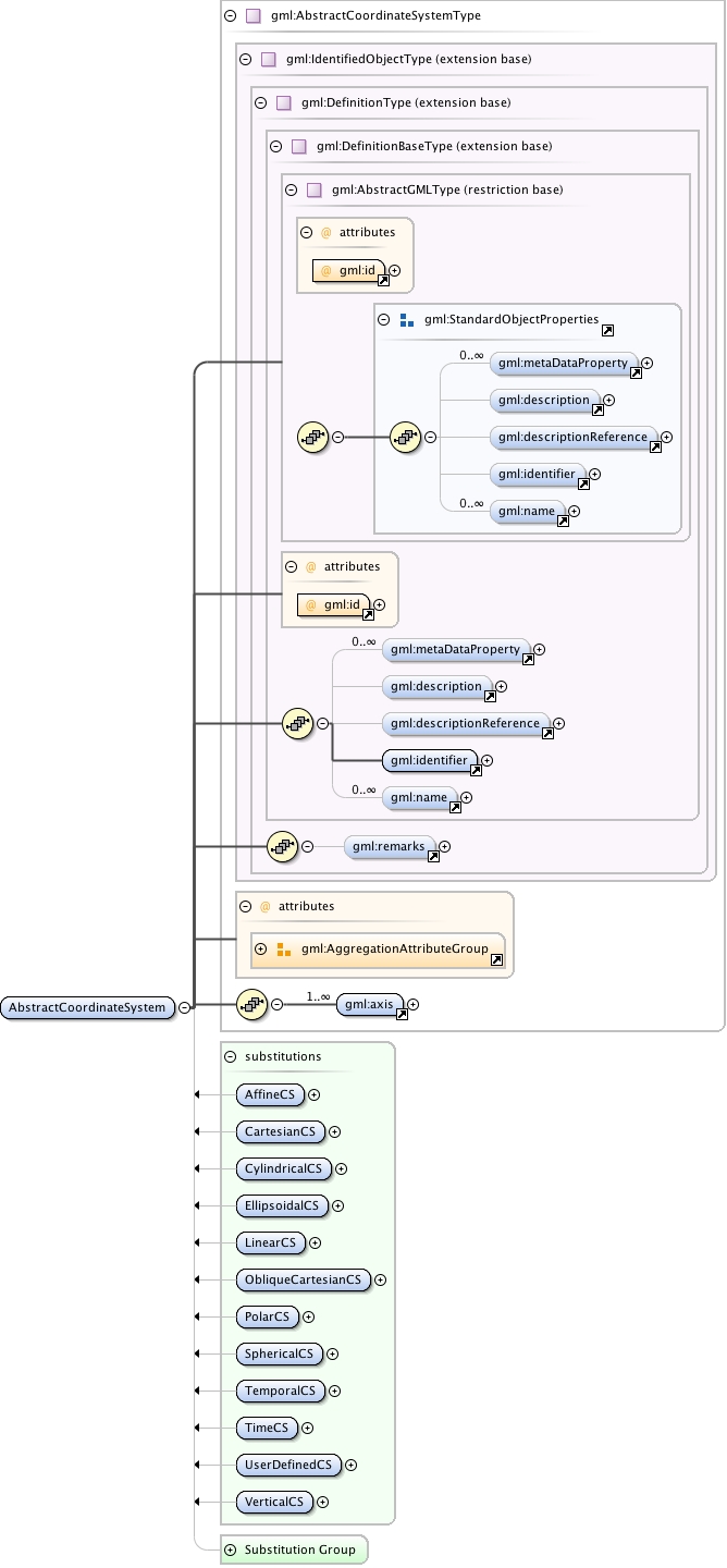
Diagram
|
 |
|||||||||||||||||||
| Type | gml:AbstractCoordinateSystemType | |||||||||||||||||||
| Type hierarchy | ||||||||||||||||||||
|
Properties
|
|
|||||||||||||||||||
|
Used by
|
|
|||||||||||||||||||
| Model | gml:metaDataProperty* , gml:description{0,1} , gml:descriptionReference{0,1} , gml:identifier , gml:name* , gml:remarks{0,1} , gml:axis+ | |||||||||||||||||||
| Children | gml:axis, gml:description, gml:descriptionReference, gml:identifier, gml:metaDataProperty, gml:name, gml:remarks | |||||||||||||||||||
|
Instance
|
|
|||||||||||||||||||
|
Attributes
|
|
|||||||||||||||||||
|
Source
|
|
|||||||||||||||||||
| Schema location | http://schemas.opengis.net/gml/3.2.1/coordinateSystems.xsd |