Showing:

Annotations
Attributes
Diagrams
Instances
Properties
Source
Used by
Element gml:AbstractCoordinateSystem
Namespace http://www.opengis.net/gml/3.2
Annotations
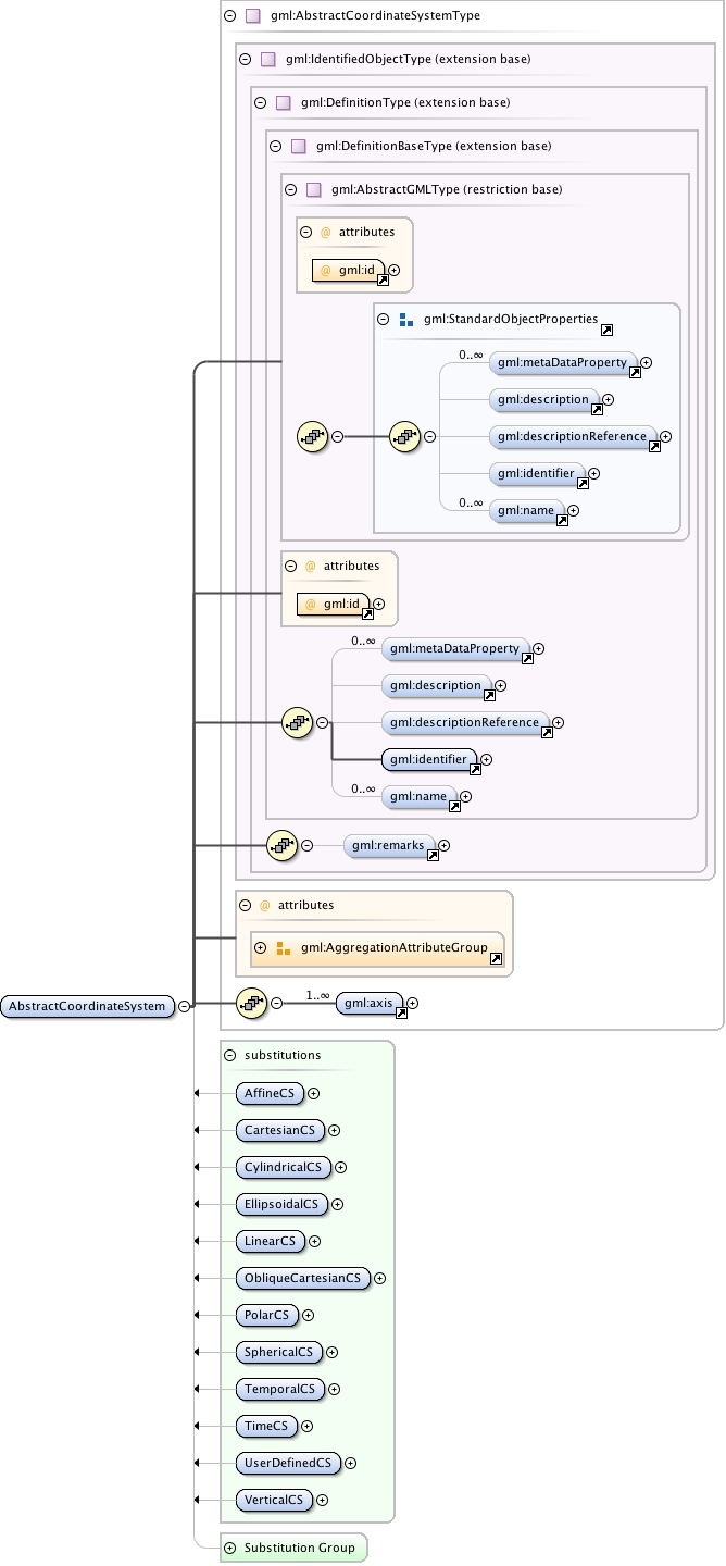
gml:AbstractCoordinateSystem is a coordinate system (CS) is the non-repeating sequence of coordinate system axes that spans a given coordinate space. A CS is derived from a set of mathematical rules for specifying how coordinates in a given space are to be assigned to points. The coordinate values in a coordinate tuple shall be recorded in the order in which the coordinate system axes associations are recorded. This abstract complex type shall not be used, extended, or restricted, in an Application Schema, to define a concrete subtype with a meaning equivalent to a concrete subtype specified in this document.
Diagram
Diagram index1.tmp#id75 index2.tmp#id69 index3.tmp#id97 index4.tmp#id99 index5.tmp#id103 index6.tmp#id108 index7.tmp#id68 index8.tmp#id67 index1.tmp#id75 index2.tmp#id69 index3.tmp#id97 index4.tmp#id99 index5.tmp#id103 index6.tmp#id108 index46.tmp#id774 index47.tmp#id775 index48.tmp#id773 index49.tmp#id1067 index31.tmp#id567 index613.tmp#id1275 index614.tmp#id1274 index327.tmp#id310 index400.tmp#id302 index165.tmp#id309 index268.tmp#id301 index897.tmp#id305 index591.tmp#id312 index1231.tmp#id308 index322.tmp#id307 index910.tmp#id311 index953.tmp#id304 index636.tmp#id306 index1058.tmp#id303
Type gml:AbstractCoordinateSystemType
Type hierarchy
Properties
content: complex
abstract: true
Used by
Model gml:metaDataProperty* , gml:description{0,1} , gml:descriptionReference{0,1} , gml:identifier , gml:name* , gml:remarks{0,1} , gml:axis+
Children gml:axis, gml:description, gml:descriptionReference, gml:identifier, gml:metaDataProperty, gml:name, gml:remarks
Instance
<gml:AbstractCoordinateSystem aggregationType="" gml:id="">
  <gml:metaDataProperty about="" xlink:actuate="" xlink:arcrole="" xlink:href="" nilReason="" gml:remoteSchema="" xlink:role="" xlink:show="" xlink:title="" xlink:type="simple">{0,unbounded}</gml:metaDataProperty>
  <gml:description xlink:actuate="" xlink:arcrole="" xlink:href="" nilReason="" gml:remoteSchema="" xlink:role="" xlink:show="" xlink:title="" xlink:type="simple">{0,1}</gml:description>
  <gml:descriptionReference xlink:actuate="" xlink:arcrole="" xlink:href="" nilReason="" owns="false" gml:remoteSchema="" xlink:role="" xlink:show="" xlink:title="" xlink:type="simple">{0,1}</gml:descriptionReference>
  <gml:identifier codeSpace="">{1,1}</gml:identifier>
  <gml:name codeSpace="">{0,unbounded}</gml:name>
</gml:AbstractCoordinateSystem>
Attributes
QName Type Fixed Default Use Annotation
aggregationType gml:AggregationType optional
gml:id ID required
The attribute gml:id supports provision of a handle for the XML element representing a GML Object. Its use is mandatory for all GML objects. It is of XML type ID, so is constrained to be unique in the XML document within which it occurs.
Source
<element name="AbstractCoordinateSystem" type="gml:AbstractCoordinateSystemType" abstract="true" substitutionGroup="gml:Definition">
  <annotation>
    <documentation>gml:AbstractCoordinateSystem is a coordinate system (CS) is the non-repeating sequence of coordinate system axes that spans a given coordinate space. A CS is derived from a set of mathematical rules for specifying how coordinates in a given space are to be assigned to points. The coordinate values in a coordinate tuple shall be recorded in the order in which the coordinate system axes associations are recorded. This abstract complex type shall not be used, extended, or restricted, in an Application Schema, to define a concrete subtype with a meaning equivalent to a concrete subtype specified in this document.</documentation>
  </annotation>
</element>
Schema location http://schemas.opengis.net/gml/3.2.1/coordinateSystems.xsd