| Namespace | http://www.isotc211.org/2005/gmd | |||||||||||||||||||||||||||||||||||||||||||||||||||||||||
|
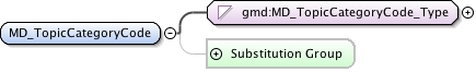
Diagram
|
 |
|||||||||||||||||||||||||||||||||||||||||||||||||||||||||
| Type | gmd:MD_TopicCategoryCode_Type | |||||||||||||||||||||||||||||||||||||||||||||||||||||||||
|
Properties
|
|
|||||||||||||||||||||||||||||||||||||||||||||||||||||||||
|
Facets
|
|
|||||||||||||||||||||||||||||||||||||||||||||||||||||||||
|
Used by
|
|
|||||||||||||||||||||||||||||||||||||||||||||||||||||||||
|
Source
|
|
|||||||||||||||||||||||||||||||||||||||||||||||||||||||||
| Schema location | http://schemas.opengis.net/iso/19139/20070417/gmd/identification.xsd |