Showing:

Annotations
Attributes
Diagrams
Instances
Properties
Source
Used by
Element gml:AbstractCoordinateSystem
Namespace http://www.opengis.net/gml/3.2
Annotations
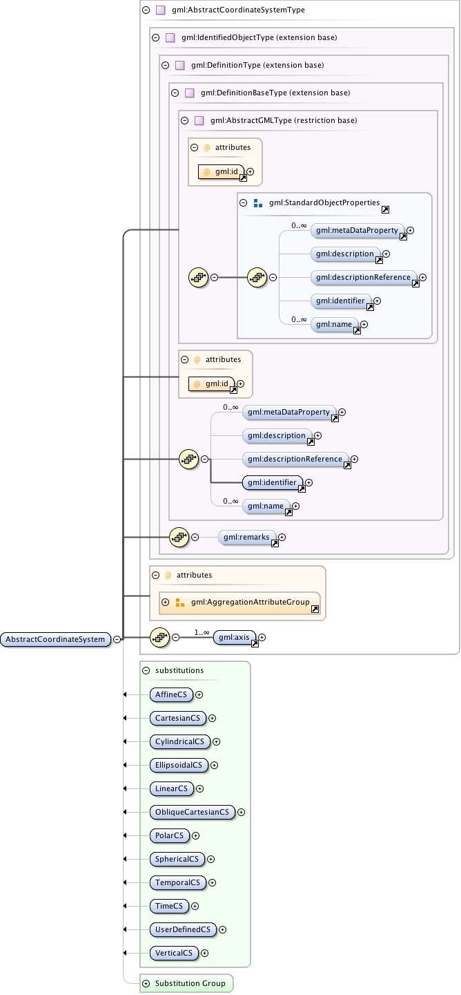
gml:AbstractCoordinateSystem is a coordinate system (CS) is the non-repeating sequence of coordinate system axes that spans a given coordinate space. A CS is derived from a set of mathematical rules for specifying how coordinates in a given space are to be assigned to points. The coordinate values in a coordinate tuple shall be recorded in the order in which the coordinate system axes associations are recorded. This abstract complex type shall not be used, extended, or restricted, in an Application Schema, to define a concrete subtype with a meaning equivalent to a concrete subtype specified in this document.
Diagram
Diagram index18.tmp#id77 index19.tmp#id71 index20.tmp#id99 index21.tmp#id101 index22.tmp#id105 index23.tmp#id110 index24.tmp#id70 index25.tmp#id69 index18.tmp#id77 index19.tmp#id71 index20.tmp#id99 index21.tmp#id101 index22.tmp#id105 index23.tmp#id110 index116.tmp#id643 index117.tmp#id644 index118.tmp#id642 index119.tmp#id986 index120.tmp#id430 index121.tmp#id1194 index122.tmp#id1193 index661.tmp#id693 index493.tmp#id685 index848.tmp#id692 index550.tmp#id684 index682.tmp#id688 index1025.tmp#id695 index513.tmp#id691 index737.tmp#id690 index1013.tmp#id694 index1026.tmp#id687 index793.tmp#id689 index728.tmp#id686
Type gml:AbstractCoordinateSystemType
Type hierarchy
Properties
content: complex
abstract: true
Used by
Model gml:metaDataProperty* , gml:description{0,1} , gml:descriptionReference{0,1} , gml:identifier , gml:name* , gml:remarks{0,1} , gml:axis+
Children gml:axis, gml:description, gml:descriptionReference, gml:identifier, gml:metaDataProperty, gml:name, gml:remarks
Instance
<gml:AbstractCoordinateSystem aggregationType="" gml:id="">
  <gml:metaDataProperty about="" xlink:actuate="" xlink:arcrole="" xlink:href="" nilReason="" gml:remoteSchema="" xlink:role="" xlink:show="" xlink:title="" xlink:type="simple">{0,unbounded}</gml:metaDataProperty>
  <gml:description xlink:actuate="" xlink:arcrole="" xlink:href="" nilReason="" gml:remoteSchema="" xlink:role="" xlink:show="" xlink:title="" xlink:type="simple">{0,1}</gml:description>
  <gml:descriptionReference xlink:actuate="" xlink:arcrole="" xlink:href="" nilReason="" owns="false" gml:remoteSchema="" xlink:role="" xlink:show="" xlink:title="" xlink:type="simple">{0,1}</gml:descriptionReference>
  <gml:identifier codeSpace="">{1,1}</gml:identifier>
  <gml:name codeSpace="">{0,unbounded}</gml:name>
</gml:AbstractCoordinateSystem>
Attributes
QName Type Fixed Default Use Annotation
aggregationType gml:AggregationType optional
gml:id ID required
The attribute gml:id supports provision of a handle for the XML element representing a GML Object. Its use is mandatory for all GML objects. It is of XML type ID, so is constrained to be unique in the XML document within which it occurs.
Source
<element name="AbstractCoordinateSystem" type="gml:AbstractCoordinateSystemType" abstract="true" substitutionGroup="gml:Definition">
  <annotation>
    <documentation>gml:AbstractCoordinateSystem is a coordinate system (CS) is the non-repeating sequence of coordinate system axes that spans a given coordinate space. A CS is derived from a set of mathematical rules for specifying how coordinates in a given space are to be assigned to points. The coordinate values in a coordinate tuple shall be recorded in the order in which the coordinate system axes associations are recorded. This abstract complex type shall not be used, extended, or restricted, in an Application Schema, to define a concrete subtype with a meaning equivalent to a concrete subtype specified in this document.</documentation>
  </annotation>
</element>
Schema location http://schemas.opengis.net/gml/3.2.1/coordinateSystems.xsd