| Namespace | http://www.opengis.net/gml/3.2 | |||||||||||||
|
Annotations
|
|
|||||||||||||
|
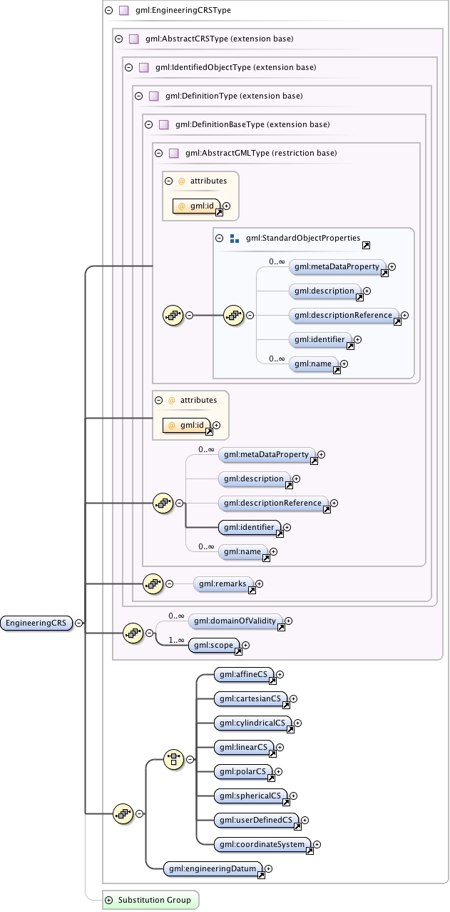
Diagram
|
 |
|||||||||||||
| Type | gml:EngineeringCRSType | |||||||||||||
| Type hierarchy | ||||||||||||||
|
Properties
|
|
|||||||||||||
|
Used by
|
|
|||||||||||||
| Model | gml:metaDataProperty* , gml:description{0,1} , gml:descriptionReference{0,1} , gml:identifier , gml:name* , gml:remarks{0,1} , gml:domainOfValidity* , gml:scope+ , (gml:affineCS | gml:cartesianCS | gml:cylindricalCS | gml:linearCS | gml:polarCS | gml:sphericalCS | gml:userDefinedCS | gml:coordinateSystem) , gml:engineeringDatum | |||||||||||||
| Children | gml:affineCS, gml:cartesianCS, gml:coordinateSystem, gml:cylindricalCS, gml:description, gml:descriptionReference, gml:domainOfValidity, gml:engineeringDatum, gml:identifier, gml:linearCS, gml:metaDataProperty, gml:name, gml:polarCS, gml:remarks, gml:scope, gml:sphericalCS, gml:userDefinedCS | |||||||||||||
|
Instance
|
|
|||||||||||||
|
Attributes
|
|
|||||||||||||
|
Source
|
|
|||||||||||||
| Schema location | http://schemas.opengis.net/gml/3.2.1/coordinateReferenceSystems.xsd |