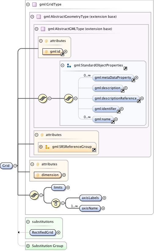
The gml:Grid implicitly defines an unrectified grid, which is a network composed of two or more sets of curves in which the members of each set intersect the members of the other sets in an algorithmic way.  The region of interest within the grid is given in terms of its gml:limits, being the grid coordinates of  diagonally opposed corners of a rectangular region.  gml:axisLabels is provided with a list of labels of the axes of the grid (gml:axisName has been deprecated). gml:dimension specifies the dimension of the grid.
The gml:limits element contains a single gml:GridEnvelope. The gml:low and gml:high property elements of the envelope are each integerLists, which are coordinate tuples, the coordinates being measured as offsets from the origin of the grid along each axis, of the diagonally opposing corners of a "rectangular" region of interest.
The attribute gml:id supports provision of a handle for the XML element representing a GML Object. Its use is mandatory for all GML objects. It is of XML type ID, so is constrained to be unique in the XML document within which it occurs.
<element name="Grid" type="gml:GridType" substitutionGroup="gml:AbstractImplicitGeometry"><annotation><documentation>The gml:Grid implicitly defines an unrectified grid, which is a network composed of two or more sets of curves in which the members of each set intersect the members of the other sets in an algorithmic way. The region of interest within the grid is given in terms of its gml:limits, being the grid coordinates of diagonally opposed corners of a rectangular region. gml:axisLabels is provided with a list of labels of the axes of the grid (gml:axisName has been deprecated). gml:dimension specifies the dimension of the grid. The gml:limits element contains a single gml:GridEnvelope. The gml:low and gml:high property elements of the envelope are each integerLists, which are coordinate tuples, the coordinates being measured as offsets from the origin of the grid along each axis, of the diagonally opposing corners of a "rectangular" region of interest.</documentation></annotation></element>