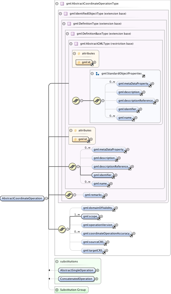
gml:AbstractCoordinateOperation is a mathematical operation on coordinates that transforms or converts coordinates to another coordinate reference system. Many but not all coordinate operations (from CRS A to CRS B) also uniquely define the inverse operation (from CRS B to CRS A). In some cases, the operation method algorithm for the inverse operation is the same as for the forward algorithm, but the signs of some operation parameter values shall be reversed. In other cases, different algorithms are required for the forward and inverse operations, but the same operation parameter values are used. If (some) entirely different parameter values are needed, a different coordinate operation shall be defined.The optional coordinateOperationAccuracy property elements provide estimates of the impact of this coordinate operation on point position accuracy.
The attribute gml:id supports provision of a handle for the XML element representing a GML Object. Its use is mandatory for all GML objects. It is of XML type ID, so is constrained to be unique in the XML document within which it occurs.
Source
<element name="AbstractCoordinateOperation" type="gml:AbstractCoordinateOperationType" abstract="true" substitutionGroup="gml:Definition"><annotation><documentation>gml:AbstractCoordinateOperation is a mathematical operation on coordinates that transforms or converts coordinates to another coordinate reference system. Many but not all coordinate operations (from CRS A to CRS B) also uniquely define the inverse operation (from CRS B to CRS A). In some cases, the operation method algorithm for the inverse operation is the same as for the forward algorithm, but the signs of some operation parameter values shall be reversed. In other cases, different algorithms are required for the forward and inverse operations, but the same operation parameter values are used. If (some) entirely different parameter values are needed, a different coordinate operation shall be defined. The optional coordinateOperationAccuracy property elements provide estimates of the impact of this coordinate operation on point position accuracy.</documentation></annotation></element>