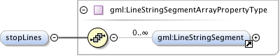
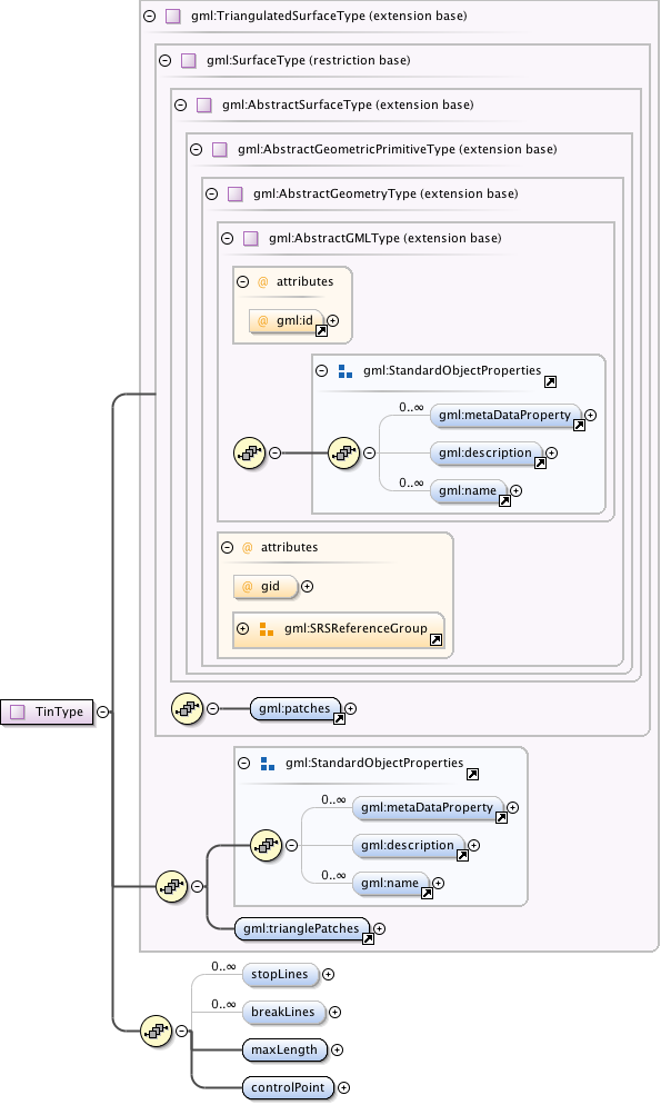
Stoplines are lines where the local
continuity or regularity of the surface is questionable.
In the area of these pathologies, triangles intersecting
a stopline shall be removed from the tin surface, leaving
holes in the surface. If coincidence occurs on surface
boundary triangles, the result shall be a change of the
surface boundary. Stoplines contains all these
pathological segments as a set of line strings.
<element name="stopLines" type="gml:LineStringSegmentArrayPropertyType" minOccurs="0" maxOccurs="unbounded"><annotation><documentation>Stoplines are lines where the local continuity or regularity of the surface is questionable. In the area of these pathologies, triangles intersecting a stopline shall be removed from the tin surface, leaving holes in the surface. If coincidence occurs on surface boundary triangles, the result shall be a change of the surface boundary. Stoplines contains all these pathological segments as a set of line strings.</documentation></annotation></element>
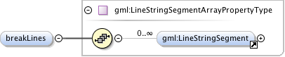
Breaklines are lines of a critical
nature to the shape of the surface, representing local
ridges, or depressions (such as drainage lines) in the
surface. As such their constituent segments must be
included in the tin eve if doing so
violates the Delauny criterion. Break lines contains these
critical segments as a set of line strings.
<element name="breakLines" type="gml:LineStringSegmentArrayPropertyType" minOccurs="0" maxOccurs="unbounded"><annotation><documentation>Breaklines are lines of a critical nature to the shape of the surface, representing local ridges, or depressions (such as drainage lines) in the surface. As such their constituent segments must be included in the tin eve if doing so violates the Delauny criterion. Break lines contains these critical segments as a set of line strings.</documentation></annotation></element>
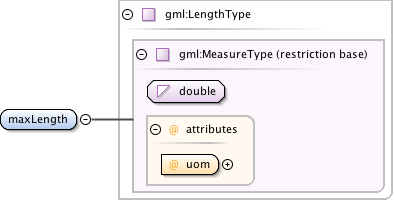
Areas of the surface where data is not
sufficiently dense to assure reasonable calculation shall be
removed by adding a retention criterion for triangles based
on the length of their sides. For many triangle sides
exceeding maximum length, the adjacent triangles to that
triangle side shall be removed from the surface.
<element name="maxLength" type="gml:LengthType"><annotation><documentation>Areas of the surface where data is not sufficiently dense to assure reasonable calculation shall be removed by adding a retention criterion for triangles based on the length of their sides. For many triangle sides exceeding maximum length, the adjacent triangles to that triangle side shall be removed from the surface.</documentation></annotation></element>
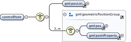
The corners of the triangles in the TIN
are often referred to as pots. ControlPoint shall contain a
set of the GM_Position used as posts for this TIN. Since each
TIN contains triangles, there must be at least 3 posts. The
order in which these points are given does not affect the
surface that is represented. Application schemas may add
information based on ordering of control points to facilitate
the reconstruction of the TIN from the control points.
<element name="controlPoint"><annotation><documentation>The corners of the triangles in the TIN are often referred to as pots. ControlPoint shall contain a set of the GM_Position used as posts for this TIN. Since each TIN contains triangles, there must be at least 3 posts. The order in which these points are given does not affect the surface that is represented. Application schemas may add information based on ordering of control points to facilitate the reconstruction of the TIN from the control points.</documentation></annotation><complexType><choice><element ref="gml:posList"/><group ref="gml:geometricPositionGroup" minOccurs="3" maxOccurs="unbounded"/></choice></complexType></element>
A tin is a triangulated surface that uses
the Delauny algorithm or a similar algorithm complemented with
consideration of breaklines, stoplines, and maximum length of
triangle sides. These networks satisfy the Delauny's criterion
away from the modifications: Fore each triangle in the
network, the circle passing through its vertices does not
contain, in its interior, the vertex of any other triangle.
Ordered list of labels for all the axes of this CRS. The gml:axisAbbrev value should be used for these axis
labels, after spaces and forbiddden characters are removed. When the srsName attribute is included, this attribute is
optional.
When the srsName attribute is omitted, this attribute shall also be omitted.
This attribute is included for backward compatibility with GML 2 and is deprecated with GML 3.
This identifer is superceded by "gml:id" inherited from AbstractGMLType. The attribute "gid" should not be used
anymore and may be deleted in future versions of GML without further notice.
Database handle for the object. It is of XML type ID, so is constrained to be unique in the XML document within which it
occurs. An external identifier for the object in the form of a URI may be constructed using standard XML and XPointer methods.
This is done by concatenating the URI for the document, a fragment separator, and the value of the id attribute.
The "srsDimension" is the length of coordinate sequence (the number of entries in the list). This dimension is
specified by the coordinate reference system. When the srsName attribute is omitted, this attribute shall be omitted.
In general this reference points to a CRS instance of gml:CoordinateReferenceSystemType
(see coordinateReferenceSystems.xsd). For well known references it is not required that the CRS description exists at
the
location the URI points to. If no srsName attribute is given, the CRS must be specified as part of the larger context
this
geometry element is part of, e.g. a geometric element like point, curve, etc. It is expected that this attribute will
be specified
at the direct position level only in rare cases.
Ordered list of unit of measure (uom) labels for all the axes of this CRS. The value of the string in the
gml:catalogSymbol should be used for this uom labels, after spaces and forbiddden characters are removed. When the
axisLabels attribute is included, this attribute shall also be included. When the axisLabels attribute is omitted, this
attribute
shall also be omitted.
Source
<complexType name="TinType"><annotation><documentation>A tin is a triangulated surface that uses the Delauny algorithm or a similar algorithm complemented with consideration of breaklines, stoplines, and maximum length of triangle sides. These networks satisfy the Delauny's criterion away from the modifications: Fore each triangle in the network, the circle passing through its vertices does not contain, in its interior, the vertex of any other triangle.</documentation></annotation><complexContent><extension base="gml:TriangulatedSurfaceType"><sequence><element name="stopLines" type="gml:LineStringSegmentArrayPropertyType" minOccurs="0" maxOccurs="unbounded"><annotation><documentation>Stoplines are lines where the local continuity or regularity of the surface is questionable. In the area of these pathologies, triangles intersecting a stopline shall be removed from the tin surface, leaving holes in the surface. If coincidence occurs on surface boundary triangles, the result shall be a change of the surface boundary. Stoplines contains all these pathological segments as a set of line strings.</documentation></annotation></element><element name="breakLines" type="gml:LineStringSegmentArrayPropertyType" minOccurs="0" maxOccurs="unbounded"><annotation><documentation>Breaklines are lines of a critical nature to the shape of the surface, representing local ridges, or depressions (such as drainage lines) in the surface. As such their constituent segments must be included in the tin eve if doing so violates the Delauny criterion. Break lines contains these critical segments as a set of line strings.</documentation></annotation></element><element name="maxLength" type="gml:LengthType"><annotation><documentation>Areas of the surface where data is not sufficiently dense to assure reasonable calculation shall be removed by adding a retention criterion for triangles based on the length of their sides. For many triangle sides exceeding maximum length, the adjacent triangles to that triangle side shall be removed from the surface.</documentation></annotation></element><element name="controlPoint"><annotation><documentation>The corners of the triangles in the TIN are often referred to as pots. ControlPoint shall contain a set of the GM_Position used as posts for this TIN. Since each TIN contains triangles, there must be at least 3 posts. The order in which these points are given does not affect the surface that is represented. Application schemas may add information based on ordering of control points to facilitate the reconstruction of the TIN from the control points.</documentation></annotation><complexType><choice><element ref="gml:posList"/><group ref="gml:geometricPositionGroup" minOccurs="3" maxOccurs="unbounded"/></choice></complexType></element></sequence></extension></complexContent></complexType>