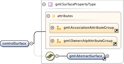
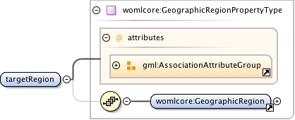
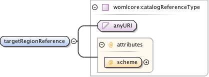
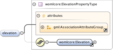
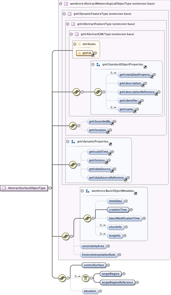
Surface object's area is defined by a continuous surface as the value of theelement "controlSurface". The surface consists of a single exterior ringan arbitrary amount of interior rings ("holes" inside the area). Each ringmay consist an arbitrary amount of cubic spline or line string segments. Surface interpolation is always "planar", meaning that all the points ofthe surface, including the exterior and interior rings, are on the sameplane. The vertical position of this plane may be given by using the "elevation" element.The object's surface may or may not be a named geographic region or a set of regions. These regions may be identified by using "targetRegion" or "targetRegionReference"elements. If the boundaries of the target regions (if available) should be considered as informational, the area of this object is always defined by its primary geometry ("controlSurface").If the "elevation"property is given, its value must be added to possible height value of each of thepoints in the each line segment. If the CRS of the points is 2-dimensional, thevalue of the elevation should be interpreted as the static height value of each ofthe given (control)points.
The attribute gml:id supports provision of a handle for the XML element representing a GML Object. Its use is mandatory for all GML objects. It is of XML type ID, so is constrained to be unique in the XML document within which it occurs.
Source
<complexType name="AbstractSurfaceObjectType"><annotation><documentation>Surface object's area is defined by a continuous surface as the value of the element "controlSurface". The surface consists of a single exterior ring an arbitrary amount of interior rings ("holes" inside the area). Each ring may consist an arbitrary amount of cubic spline or line string segments. Surface interpolation is always "planar", meaning that all the points of the surface, including the exterior and interior rings, are on the same plane. The vertical position of this plane may be given by using the "elevation" element. The object's surface may or may not be a named geographic region or a set of regions. These regions may be identified by using "targetRegion" or "targetRegionReference" elements. If the boundaries of the target regions (if available) should be considered as informational, the area of this object is always defined by its primary geometry ("controlSurface"). If the "elevation" property is given, its value must be added to possible height value of each of the points in the each line segment. If the CRS of the points is 2-dimensional, the value of the elevation should be interpreted as the static height value of each of the given (control)points.</documentation></annotation><complexContent><extension base="womlcore:AbstractMeteorologicalObjectType"><sequence><element name="controlSurface" type="gml:SurfacePropertyType" minOccurs="1" maxOccurs="1"/><choice minOccurs="0" maxOccurs="unbounded"><element name="targetRegion" type="womlcore:GeographicRegionPropertyType" minOccurs="1" maxOccurs="1"/><element name="targetRegionReference" type="womlcore:catalogReferenceType" minOccurs="1" maxOccurs="1"/></choice><element name="elevation" type="womlcore:ElevationPropertyType" minOccurs="0" maxOccurs="1"/></sequence></extension></complexContent></complexType>