| Namespace | http://www.opengis.net/gml/3.2 | ||||||||||||||||||||
|
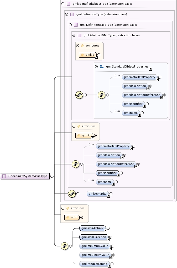
Diagram
|
 |
||||||||||||||||||||
| Type | extension of gml:IdentifiedObjectType | ||||||||||||||||||||
| Type hierarchy | |||||||||||||||||||||
|
Used by
|
|
||||||||||||||||||||
| Model | gml:metaDataProperty* , gml:description{0,1} , gml:descriptionReference{0,1} , gml:identifier , gml:name* , gml:remarks{0,1} , gml:axisAbbrev , gml:axisDirection , gml:minimumValue{0,1} , gml:maximumValue{0,1} , gml:rangeMeaning{0,1} | ||||||||||||||||||||
| Children | gml:axisAbbrev, gml:axisDirection, gml:description, gml:descriptionReference, gml:identifier, gml:maximumValue, gml:metaDataProperty, gml:minimumValue, gml:name, gml:rangeMeaning, gml:remarks | ||||||||||||||||||||
|
Attributes
|
|
||||||||||||||||||||
|
Source
|
|
||||||||||||||||||||
| Schema location | http://schemas.opengis.net/gml/3.2.1/coordinateSystems.xsd |