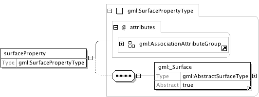
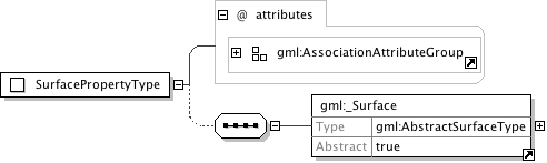
This property element either references a surface via the XLink-attributes or contains the surface element. surfaceProperty is the predefined property which can be used by GML Application Schemas whenever a GML Feature has a property with a value that is substitutable for _Surface.
Reference to an XML Schema fragment that specifies the content model of the propertys value. This is in conformance with the XML Schema Section 4.14 Referencing Schemas from Elsewhere.
The 'actuate' attribute is used to communicate the desired timingof traversal from the starting resource to the ending resource;it's value should be treated as follows:onLoad - traverse to the ending resource immediately on loadingthe starting resourceonRequest - traverse from the starting resource to the endingresource only on a post-loading event triggered forthis purposeother - behavior is unconstrained; examine other markup in linkfor hintsnone - behavior is unconstrained
The 'show' attribute is used to communicate the desired presentationof the ending resource on traversal from the starting resource; it'svalue should be treated as follows:new - load ending resource in a new window, frame, pane, or otherpresentation contextreplace - load the resource in the same window, frame, pane, orother presentation contextembed - load ending resource in place of the presentation of thestarting resourceother - behavior is unconstrained; examine other markup in thelink for hintsnone - behavior is unconstrained
<element name="surfaceProperty" type="gml:SurfacePropertyType"><annotation><appinfo><sch:pattern name="Check either href or content not both"><sch:rule context="gml:surfaceProperty"><sch:extends rule="hrefOrContent"/></sch:rule></sch:pattern></appinfo><documentation>This property element either references a surface via the XLink-attributes or contains the surface element. surfaceProperty is the predefined property which can be used by GML Application Schemas whenever a GML Feature has a property with a value that is substitutable for _Surface.</documentation></annotation></element>
Ordered list of labels for all the axes of this CRS. The gml:axisAbbrev value should be used for these axislabels, after spaces and forbiddden characters are removed. When the srsName attribute is included, this attribute is optional.When the srsName attribute is omitted, this attribute shall also be omitted.
This attribute is included for backward compatibility with GML 2 and is deprecated with GML 3.This identifer is superceded by "gml:id" inherited from AbstractGMLType. The attribute "gid" should not be usedanymore and may be deleted in future versions of GML without further notice.
Database handle for the object. It is of XML type ID, so is constrained to be unique in the XML document within which it occurs. An external identifier for the object in the form of a URI may be constructed using standard XML and XPointer methods. This is done by concatenating the URI for the document, a fragment separator, and the value of the id attribute.
The "srsDimension" is the length of coordinate sequence (the number of entries in the list). This dimension isspecified by the coordinate reference system. When the srsName attribute is omitted, this attribute shall be omitted.
In general this reference points to a CRS instance of gml:CoordinateReferenceSystemType(see coordinateReferenceSystems.xsd). For well known references it is not required that the CRS description exists at thelocation the URI points to. If no srsName attribute is given, the CRS must be specified as part of the larger context thisgeometry element is part of, e.g. a geometric element like point, curve, etc. It is expected that this attribute will be specifiedat the direct position level only in rare cases.
Ordered list of unit of measure (uom) labels for all the axes of this CRS. The value of the string in thegml:catalogSymbol should be used for this uom labels, after spaces and forbiddden characters are removed. When theaxisLabels attribute is included, this attribute shall also be included. When the axisLabels attribute is omitted, this attributeshall also be omitted.
Source
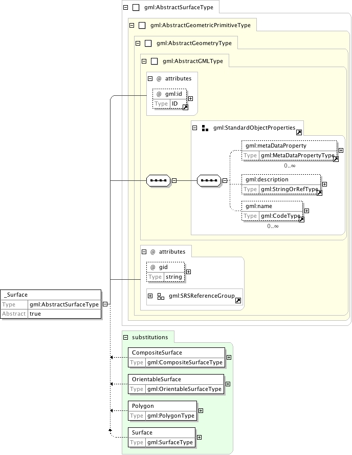
<element name="_Surface" type="gml:AbstractSurfaceType" abstract="true" substitutionGroup="gml:_GeometricPrimitive"><annotation><documentation>The "_Surface" element is the abstract head of the substituition group for all (continuous) surface elements.</documentation></annotation></element>
Ordered list of labels for all the axes of this CRS. The gml:axisAbbrev value should be used for these axislabels, after spaces and forbiddden characters are removed. When the srsName attribute is included, this attribute is optional.When the srsName attribute is omitted, this attribute shall also be omitted.
This attribute is included for backward compatibility with GML 2 and is deprecated with GML 3.This identifer is superceded by "gml:id" inherited from AbstractGMLType. The attribute "gid" should not be usedanymore and may be deleted in future versions of GML without further notice.
Database handle for the object. It is of XML type ID, so is constrained to be unique in the XML document within which it occurs. An external identifier for the object in the form of a URI may be constructed using standard XML and XPointer methods. This is done by concatenating the URI for the document, a fragment separator, and the value of the id attribute.
The "srsDimension" is the length of coordinate sequence (the number of entries in the list). This dimension isspecified by the coordinate reference system. When the srsName attribute is omitted, this attribute shall be omitted.
In general this reference points to a CRS instance of gml:CoordinateReferenceSystemType(see coordinateReferenceSystems.xsd). For well known references it is not required that the CRS description exists at thelocation the URI points to. If no srsName attribute is given, the CRS must be specified as part of the larger context thisgeometry element is part of, e.g. a geometric element like point, curve, etc. It is expected that this attribute will be specifiedat the direct position level only in rare cases.
Ordered list of unit of measure (uom) labels for all the axes of this CRS. The value of the string in thegml:catalogSymbol should be used for this uom labels, after spaces and forbiddden characters are removed. When theaxisLabels attribute is included, this attribute shall also be included. When the axisLabels attribute is omitted, this attributeshall also be omitted.
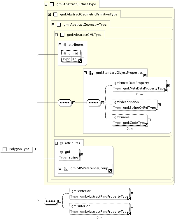
A boundary of a surface consists of a number of rings. In the normal 2D case, one of these rings is distinguished as being the exterior boundary. In a general manifold this is not always possible, in which case all boundaries shall be listed as interior boundaries, and the exterior will be empty.
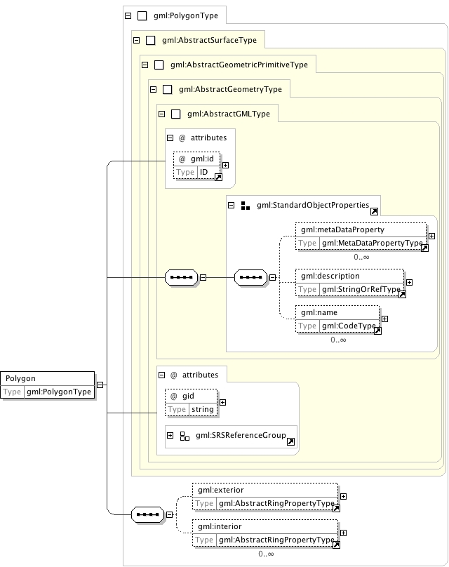
<element name="exterior" type="gml:AbstractRingPropertyType"><annotation><documentation>A boundary of a surface consists of a number of rings. In the normal 2D case, one of these rings is distinguished as being the exterior boundary. In a general manifold this is not always possible, in which case all boundaries shall be listed as interior boundaries, and the exterior will be empty.</documentation></annotation></element>
Ordered list of labels for all the axes of this CRS. The gml:axisAbbrev value should be used for these axislabels, after spaces and forbiddden characters are removed. When the srsName attribute is included, this attribute is optional.When the srsName attribute is omitted, this attribute shall also be omitted.
This attribute is included for backward compatibility with GML 2 and is deprecated with GML 3.This identifer is superceded by "gml:id" inherited from AbstractGMLType. The attribute "gid" should not be usedanymore and may be deleted in future versions of GML without further notice.
Database handle for the object. It is of XML type ID, so is constrained to be unique in the XML document within which it occurs. An external identifier for the object in the form of a URI may be constructed using standard XML and XPointer methods. This is done by concatenating the URI for the document, a fragment separator, and the value of the id attribute.
The "srsDimension" is the length of coordinate sequence (the number of entries in the list). This dimension isspecified by the coordinate reference system. When the srsName attribute is omitted, this attribute shall be omitted.
In general this reference points to a CRS instance of gml:CoordinateReferenceSystemType(see coordinateReferenceSystems.xsd). For well known references it is not required that the CRS description exists at thelocation the URI points to. If no srsName attribute is given, the CRS must be specified as part of the larger context thisgeometry element is part of, e.g. a geometric element like point, curve, etc. It is expected that this attribute will be specifiedat the direct position level only in rare cases.
Ordered list of unit of measure (uom) labels for all the axes of this CRS. The value of the string in thegml:catalogSymbol should be used for this uom labels, after spaces and forbiddden characters are removed. When theaxisLabels attribute is included, this attribute shall also be included. When the axisLabels attribute is omitted, this attributeshall also be omitted.
Source
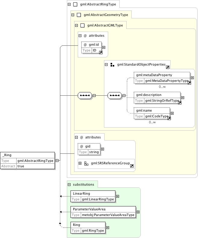
<element name="_Ring" type="gml:AbstractRingType" abstract="true" substitutionGroup="gml:_Geometry"><annotation><documentation>The "_Ring" element is the abstract head of the substituition group for all closed boundaries of a surface patch.</documentation></annotation></element>
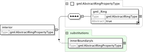
<element name="interior" type="gml:AbstractRingPropertyType"><annotation><documentation>A boundary of a surface consists of a number of rings. The "interior" rings seperate the surface / surface patch from the area enclosed by the rings.</documentation></annotation></element>
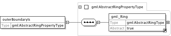
<element name="outerBoundaryIs" type="gml:AbstractRingPropertyType" substitutionGroup="gml:exterior"><annotation><documentation>Deprecated with GML 3.0, included only for backwards compatibility with GML 2. Use "exterior" instead.</documentation></annotation></element>
<element name="innerBoundaryIs" type="gml:AbstractRingPropertyType" substitutionGroup="gml:interior"><annotation><documentation>Deprecated with GML 3.0, included only for backwards compatibility with GML 2. Use "interior" instead.</documentation></annotation></element>
Ordered list of labels for all the axes of this CRS. The gml:axisAbbrev value should be used for these axislabels, after spaces and forbiddden characters are removed. When the srsName attribute is included, this attribute is optional.When the srsName attribute is omitted, this attribute shall also be omitted.
This attribute is included for backward compatibility with GML 2 and is deprecated with GML 3.This identifer is superceded by "gml:id" inherited from AbstractGMLType. The attribute "gid" should not be usedanymore and may be deleted in future versions of GML without further notice.
Database handle for the object. It is of XML type ID, so is constrained to be unique in the XML document within which it occurs. An external identifier for the object in the form of a URI may be constructed using standard XML and XPointer methods. This is done by concatenating the URI for the document, a fragment separator, and the value of the id attribute.
The "srsDimension" is the length of coordinate sequence (the number of entries in the list). This dimension isspecified by the coordinate reference system. When the srsName attribute is omitted, this attribute shall be omitted.
In general this reference points to a CRS instance of gml:CoordinateReferenceSystemType(see coordinateReferenceSystems.xsd). For well known references it is not required that the CRS description exists at thelocation the URI points to. If no srsName attribute is given, the CRS must be specified as part of the larger context thisgeometry element is part of, e.g. a geometric element like point, curve, etc. It is expected that this attribute will be specifiedat the direct position level only in rare cases.
Ordered list of unit of measure (uom) labels for all the axes of this CRS. The value of the string in thegml:catalogSymbol should be used for this uom labels, after spaces and forbiddden characters are removed. When theaxisLabels attribute is included, this attribute shall also be included. When the axisLabels attribute is omitted, this attributeshall also be omitted.
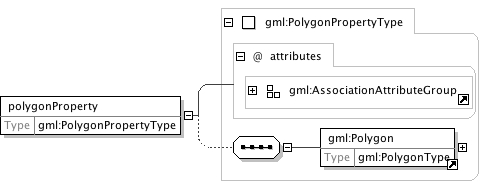
Deprecated with GML 3.0 and included only for backwards compatibility with GML 2.0. Use "surfaceProperty" instead.This property element either references a polygon via the XLink-attributes or contains the polygon element.
Reference to an XML Schema fragment that specifies the content model of the propertys value. This is in conformance with the XML Schema Section 4.14 Referencing Schemas from Elsewhere.
The 'actuate' attribute is used to communicate the desired timingof traversal from the starting resource to the ending resource;it's value should be treated as follows:onLoad - traverse to the ending resource immediately on loadingthe starting resourceonRequest - traverse from the starting resource to the endingresource only on a post-loading event triggered forthis purposeother - behavior is unconstrained; examine other markup in linkfor hintsnone - behavior is unconstrained
The 'show' attribute is used to communicate the desired presentationof the ending resource on traversal from the starting resource; it'svalue should be treated as follows:new - load ending resource in a new window, frame, pane, or otherpresentation contextreplace - load the resource in the same window, frame, pane, orother presentation contextembed - load ending resource in place of the presentation of thestarting resourceother - behavior is unconstrained; examine other markup in thelink for hintsnone - behavior is unconstrained
<element name="polygonProperty" type="gml:PolygonPropertyType"><annotation><documentation>Deprecated with GML 3.0 and included only for backwards compatibility with GML 2.0. Use "surfaceProperty" instead. This property element either references a polygon via the XLink-attributes or contains the polygon element.</documentation></annotation></element>
A property that has a surface as its value domain can either be an appropriate geometry element encapsulated in an element of this type or an XLink reference to a remote geometry element (where remote includes geometry elements located elsewhere in the same document). Either the reference or the contained element must be given, but neither both nor none.
Reference to an XML Schema fragment that specifies the content model of the propertys value. This is in conformance with the XML Schema Section 4.14 Referencing Schemas from Elsewhere.
The 'actuate' attribute is used to communicate the desired timingof traversal from the starting resource to the ending resource;it's value should be treated as follows:onLoad - traverse to the ending resource immediately on loadingthe starting resourceonRequest - traverse from the starting resource to the endingresource only on a post-loading event triggered forthis purposeother - behavior is unconstrained; examine other markup in linkfor hintsnone - behavior is unconstrained
The 'show' attribute is used to communicate the desired presentationof the ending resource on traversal from the starting resource; it'svalue should be treated as follows:new - load ending resource in a new window, frame, pane, or otherpresentation contextreplace - load the resource in the same window, frame, pane, orother presentation contextembed - load ending resource in place of the presentation of thestarting resourceother - behavior is unconstrained; examine other markup in thelink for hintsnone - behavior is unconstrained
<complexType name="SurfacePropertyType"><annotation><documentation>A property that has a surface as its value domain can either be an appropriate geometry element encapsulated in an element of this type or an XLink reference to a remote geometry element (where remote includes geometry elements located elsewhere in the same document). Either the reference or the contained element must be given, but neither both nor none.</documentation></annotation><sequence minOccurs="0"><element ref="gml:_Surface"/></sequence><attributeGroup ref="gml:AssociationAttributeGroup"><annotation><documentation>This attribute group includes the XLink attributes (see xlinks.xsd). XLink is used in GML to reference remote resources (including those elsewhere in the same document). A simple link element can be constructed by including a specific set of XLink attributes. The XML Linking Language (XLink) is currently a Proposed Recommendation of the World Wide Web Consortium. XLink allows elements to be inserted into XML documents so as to create sophisticated links between resources; such links can be used to reference remote properties. A simple link element can be used to implement pointer functionality, and this functionality has been built into various GML 3 elements by including the gml:AssociationAttributeGroup.</documentation></annotation></attributeGroup></complexType>
Ordered list of labels for all the axes of this CRS. The gml:axisAbbrev value should be used for these axislabels, after spaces and forbiddden characters are removed. When the srsName attribute is included, this attribute is optional.When the srsName attribute is omitted, this attribute shall also be omitted.
This attribute is included for backward compatibility with GML 2 and is deprecated with GML 3.This identifer is superceded by "gml:id" inherited from AbstractGMLType. The attribute "gid" should not be usedanymore and may be deleted in future versions of GML without further notice.
Database handle for the object. It is of XML type ID, so is constrained to be unique in the XML document within which it occurs. An external identifier for the object in the form of a URI may be constructed using standard XML and XPointer methods. This is done by concatenating the URI for the document, a fragment separator, and the value of the id attribute.
The "srsDimension" is the length of coordinate sequence (the number of entries in the list). This dimension isspecified by the coordinate reference system. When the srsName attribute is omitted, this attribute shall be omitted.
In general this reference points to a CRS instance of gml:CoordinateReferenceSystemType(see coordinateReferenceSystems.xsd). For well known references it is not required that the CRS description exists at thelocation the URI points to. If no srsName attribute is given, the CRS must be specified as part of the larger context thisgeometry element is part of, e.g. a geometric element like point, curve, etc. It is expected that this attribute will be specifiedat the direct position level only in rare cases.
Ordered list of unit of measure (uom) labels for all the axes of this CRS. The value of the string in thegml:catalogSymbol should be used for this uom labels, after spaces and forbiddden characters are removed. When theaxisLabels attribute is included, this attribute shall also be included. When the axisLabels attribute is omitted, this attributeshall also be omitted.
Source
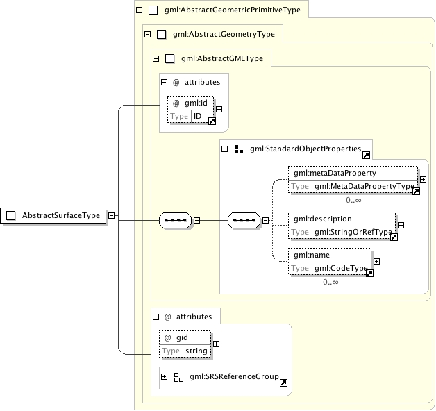
<complexType name="AbstractSurfaceType"><annotation><documentation>An abstraction of a surface to support the different levels of complexity. A surface is always a continuous region of a plane.</documentation></annotation><complexContent><extension base="gml:AbstractGeometricPrimitiveType"/></complexContent></complexType>
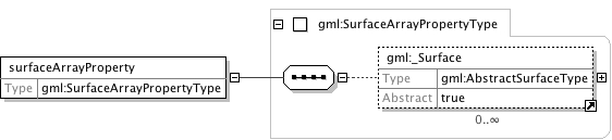
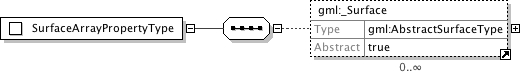
A container for an array of surfaces. The elements are always contained in the array property, referencing geometry elements or arrays of geometry elements is not supported.
<complexType name="SurfaceArrayPropertyType"><annotation><documentation>A container for an array of surfaces. The elements are always contained in the array property, referencing geometry elements or arrays of geometry elements is not supported.</documentation></annotation><sequence><element ref="gml:_Surface" minOccurs="0" maxOccurs="unbounded"/></sequence></complexType>
This type is deprecated with GML 3 and shall not be used. It is included for backwards compatibility with GML 2. Use SurfacePropertyType instead.A property that has a polygon as its value domain can either be an appropriate geometry element encapsulated in an element of this type or an XLink reference to a remote geometry element (where remote includes geometry elements located elsewhere in the same document). Either the reference or the contained element must be given, but neither both nor none.
Reference to an XML Schema fragment that specifies the content model of the propertys value. This is in conformance with the XML Schema Section 4.14 Referencing Schemas from Elsewhere.
The 'actuate' attribute is used to communicate the desired timingof traversal from the starting resource to the ending resource;it's value should be treated as follows:onLoad - traverse to the ending resource immediately on loadingthe starting resourceonRequest - traverse from the starting resource to the endingresource only on a post-loading event triggered forthis purposeother - behavior is unconstrained; examine other markup in linkfor hintsnone - behavior is unconstrained
The 'show' attribute is used to communicate the desired presentationof the ending resource on traversal from the starting resource; it'svalue should be treated as follows:new - load ending resource in a new window, frame, pane, or otherpresentation contextreplace - load the resource in the same window, frame, pane, orother presentation contextembed - load ending resource in place of the presentation of thestarting resourceother - behavior is unconstrained; examine other markup in thelink for hintsnone - behavior is unconstrained
<complexType name="PolygonPropertyType"><annotation><documentation>This type is deprecated with GML 3 and shall not be used. It is included for backwards compatibility with GML 2. Use SurfacePropertyType instead. A property that has a polygon as its value domain can either be an appropriate geometry element encapsulated in an element of this type or an XLink reference to a remote geometry element (where remote includes geometry elements located elsewhere in the same document). Either the reference or the contained element must be given, but neither both nor none.</documentation></annotation><sequence minOccurs="0"><element ref="gml:Polygon"/></sequence><attributeGroup ref="gml:AssociationAttributeGroup"><annotation><documentation>This attribute group includes the XLink attributes (see xlinks.xsd). XLink is used in GML to reference remote resources (including those elsewhere in the same document). A simple link element can be constructed by including a specific set of XLink attributes. The XML Linking Language (XLink) is currently a Proposed Recommendation of the World Wide Web Consortium. XLink allows elements to be inserted into XML documents so as to create sophisticated links between resources; such links can be used to reference remote properties. A simple link element can be used to implement pointer functionality, and this functionality has been built into various GML 3 elements by including the gml:AssociationAttributeGroup.</documentation></annotation></attributeGroup></complexType>
A Polygon is a special surface that is defined by a single surface patch. The boundary of this patch is coplanar and the polygon uses planar interpolation in its interior. It is backwards compatible with the Polygon of GML 2, GM_Polygon of ISO 19107 is implemented by PolygonPatch.
Ordered list of labels for all the axes of this CRS. The gml:axisAbbrev value should be used for these axislabels, after spaces and forbiddden characters are removed. When the srsName attribute is included, this attribute is optional.When the srsName attribute is omitted, this attribute shall also be omitted.
This attribute is included for backward compatibility with GML 2 and is deprecated with GML 3.This identifer is superceded by "gml:id" inherited from AbstractGMLType. The attribute "gid" should not be usedanymore and may be deleted in future versions of GML without further notice.
Database handle for the object. It is of XML type ID, so is constrained to be unique in the XML document within which it occurs. An external identifier for the object in the form of a URI may be constructed using standard XML and XPointer methods. This is done by concatenating the URI for the document, a fragment separator, and the value of the id attribute.
The "srsDimension" is the length of coordinate sequence (the number of entries in the list). This dimension isspecified by the coordinate reference system. When the srsName attribute is omitted, this attribute shall be omitted.
In general this reference points to a CRS instance of gml:CoordinateReferenceSystemType(see coordinateReferenceSystems.xsd). For well known references it is not required that the CRS description exists at thelocation the URI points to. If no srsName attribute is given, the CRS must be specified as part of the larger context thisgeometry element is part of, e.g. a geometric element like point, curve, etc. It is expected that this attribute will be specifiedat the direct position level only in rare cases.
Ordered list of unit of measure (uom) labels for all the axes of this CRS. The value of the string in thegml:catalogSymbol should be used for this uom labels, after spaces and forbiddden characters are removed. When theaxisLabels attribute is included, this attribute shall also be included. When the axisLabels attribute is omitted, this attributeshall also be omitted.
Source
<complexType name="PolygonType"><annotation><documentation>A Polygon is a special surface that is defined by a single surface patch. The boundary of this patch is coplanar and the polygon uses planar interpolation in its interior. It is backwards compatible with the Polygon of GML 2, GM_Polygon of ISO 19107 is implemented by PolygonPatch.</documentation></annotation><complexContent><extension base="gml:AbstractSurfaceType"><sequence><element ref="gml:exterior" minOccurs="0"/><element ref="gml:interior" minOccurs="0" maxOccurs="unbounded"/></sequence></extension></complexContent></complexType>
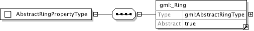
<complexType name="AbstractRingPropertyType"><annotation><documentation>Encapsulates a ring to represent the surface boundary property of a surface.</documentation></annotation><sequence><element ref="gml:_Ring"/></sequence></complexType>
Ordered list of labels for all the axes of this CRS. The gml:axisAbbrev value should be used for these axislabels, after spaces and forbiddden characters are removed. When the srsName attribute is included, this attribute is optional.When the srsName attribute is omitted, this attribute shall also be omitted.
This attribute is included for backward compatibility with GML 2 and is deprecated with GML 3.This identifer is superceded by "gml:id" inherited from AbstractGMLType. The attribute "gid" should not be usedanymore and may be deleted in future versions of GML without further notice.
Database handle for the object. It is of XML type ID, so is constrained to be unique in the XML document within which it occurs. An external identifier for the object in the form of a URI may be constructed using standard XML and XPointer methods. This is done by concatenating the URI for the document, a fragment separator, and the value of the id attribute.
The "srsDimension" is the length of coordinate sequence (the number of entries in the list). This dimension isspecified by the coordinate reference system. When the srsName attribute is omitted, this attribute shall be omitted.
In general this reference points to a CRS instance of gml:CoordinateReferenceSystemType(see coordinateReferenceSystems.xsd). For well known references it is not required that the CRS description exists at thelocation the URI points to. If no srsName attribute is given, the CRS must be specified as part of the larger context thisgeometry element is part of, e.g. a geometric element like point, curve, etc. It is expected that this attribute will be specifiedat the direct position level only in rare cases.
Ordered list of unit of measure (uom) labels for all the axes of this CRS. The value of the string in thegml:catalogSymbol should be used for this uom labels, after spaces and forbiddden characters are removed. When theaxisLabels attribute is included, this attribute shall also be included. When the axisLabels attribute is omitted, this attributeshall also be omitted.
Source
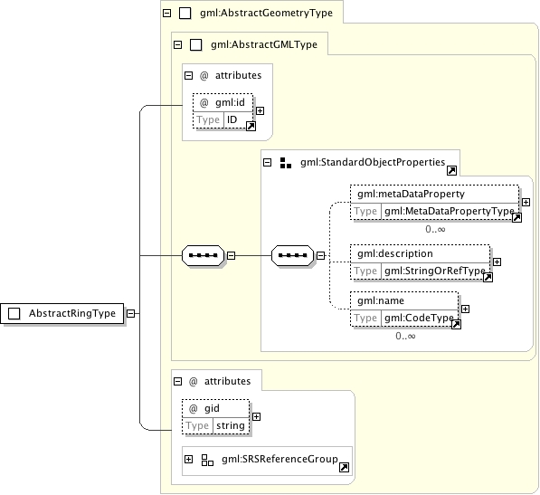
<complexType name="AbstractRingType" abstract="true"><annotation><documentation>An abstraction of a ring to support surface boundaries of different complexity.</documentation></annotation><complexContent><extension base="gml:AbstractGeometryType"/></complexContent></complexType>
Ordered list of labels for all the axes of this CRS. The gml:axisAbbrev value should be used for these axislabels, after spaces and forbiddden characters are removed. When the srsName attribute is included, this attribute is optional.When the srsName attribute is omitted, this attribute shall also be omitted.
This attribute is included for backward compatibility with GML 2 and is deprecated with GML 3.This identifer is superceded by "gml:id" inherited from AbstractGMLType. The attribute "gid" should not be usedanymore and may be deleted in future versions of GML without further notice.
Database handle for the object. It is of XML type ID, so is constrained to be unique in the XML document within which it occurs. An external identifier for the object in the form of a URI may be constructed using standard XML and XPointer methods. This is done by concatenating the URI for the document, a fragment separator, and the value of the id attribute.
The "srsDimension" is the length of coordinate sequence (the number of entries in the list). This dimension isspecified by the coordinate reference system. When the srsName attribute is omitted, this attribute shall be omitted.
In general this reference points to a CRS instance of gml:CoordinateReferenceSystemType(see coordinateReferenceSystems.xsd). For well known references it is not required that the CRS description exists at thelocation the URI points to. If no srsName attribute is given, the CRS must be specified as part of the larger context thisgeometry element is part of, e.g. a geometric element like point, curve, etc. It is expected that this attribute will be specifiedat the direct position level only in rare cases.
Ordered list of unit of measure (uom) labels for all the axes of this CRS. The value of the string in thegml:catalogSymbol should be used for this uom labels, after spaces and forbiddden characters are removed. When theaxisLabels attribute is included, this attribute shall also be included. When the axisLabels attribute is omitted, this attributeshall also be omitted.
Source
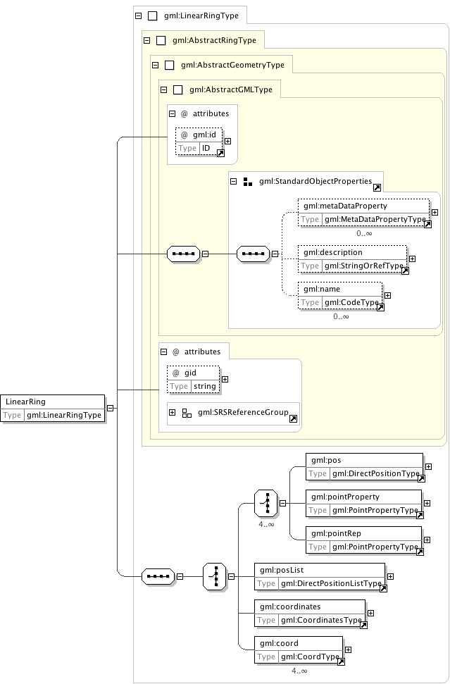
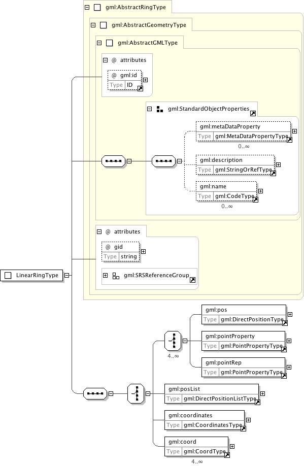
<complexType name="LinearRingType"><annotation><documentation>A LinearRing is defined by four or more coordinate tuples, with linear interpolation between them; the first and last coordinates must be coincident.</documentation></annotation><complexContent><extension base="gml:AbstractRingType"><sequence><choice><annotation><documentation>GML supports two different ways to specify the control points of a linear ring. 1. A sequence of "pos" (DirectPositionType) or "pointProperty" (PointPropertyType) elements. "pos" elements are control points that are only part of this ring, "pointProperty" elements contain a point that may be referenced from other geometry elements or reference another point defined outside of this ring (reuse of existing points). 2. The "posList" element allows for a compact way to specifiy the coordinates of the control points, if all control points are in the same coordinate reference systems and belong to this ring only. The number of direct positions in the list must be at least four.</documentation></annotation><choice minOccurs="4" maxOccurs="unbounded"><element ref="gml:pos"/><element ref="gml:pointProperty"/><element ref="gml:pointRep"><annotation><documentation>Deprecated with GML version 3.1.0. Use "pointProperty" instead. Included for backwards compatibility with GML 3.0.0.</documentation></annotation></element></choice><element ref="gml:posList"/><element ref="gml:coordinates"><annotation><documentation>Deprecated with GML version 3.1.0. Use "posList" instead.</documentation></annotation></element><element ref="gml:coord" minOccurs="4" maxOccurs="unbounded"><annotation><documentation>Deprecated with GML version 3.0 and included for backwards compatibility with GML 2. Use "pos" elements instead.</documentation></annotation></element></choice></sequence></extension></complexContent></complexType>
<complexType name="LinearRingPropertyType"><annotation><documentation>Encapsulates a ring to represent properties in features or geometry collections.</documentation></annotation><choice><element ref="gml:LinearRing"/></choice></complexType>