Reference to an XML Schema fragment that specifies the content model of the propertys value. This is in conformance with the XML Schema Section 4.14 Referencing Schemas from Elsewhere.
The 'actuate' attribute is used to communicate the desired timing of traversal from the starting resource to the ending resource; it's value should be treated as follows:onLoad - traverse to the ending resource immediately on loading the starting resource onRequest - traverse from the starting resource to the ending resource only on a post-loading event triggered for this purpose other - behavior is unconstrained; examine other markup in link for hints none - behavior is unconstrained
The 'show' attribute is used to communicate the desired presentation of the ending resource on traversal from the starting resource; it's value should be treated as follows: new - load ending resource in a new window, frame, pane, or other presentation contextreplace - load the resource in the same window, frame, pane, or other presentation contextembed - load ending resource in place of the presentation of the starting resourceother - behavior is unconstrained; examine other markup in the link for hints none - behavior is unconstrained
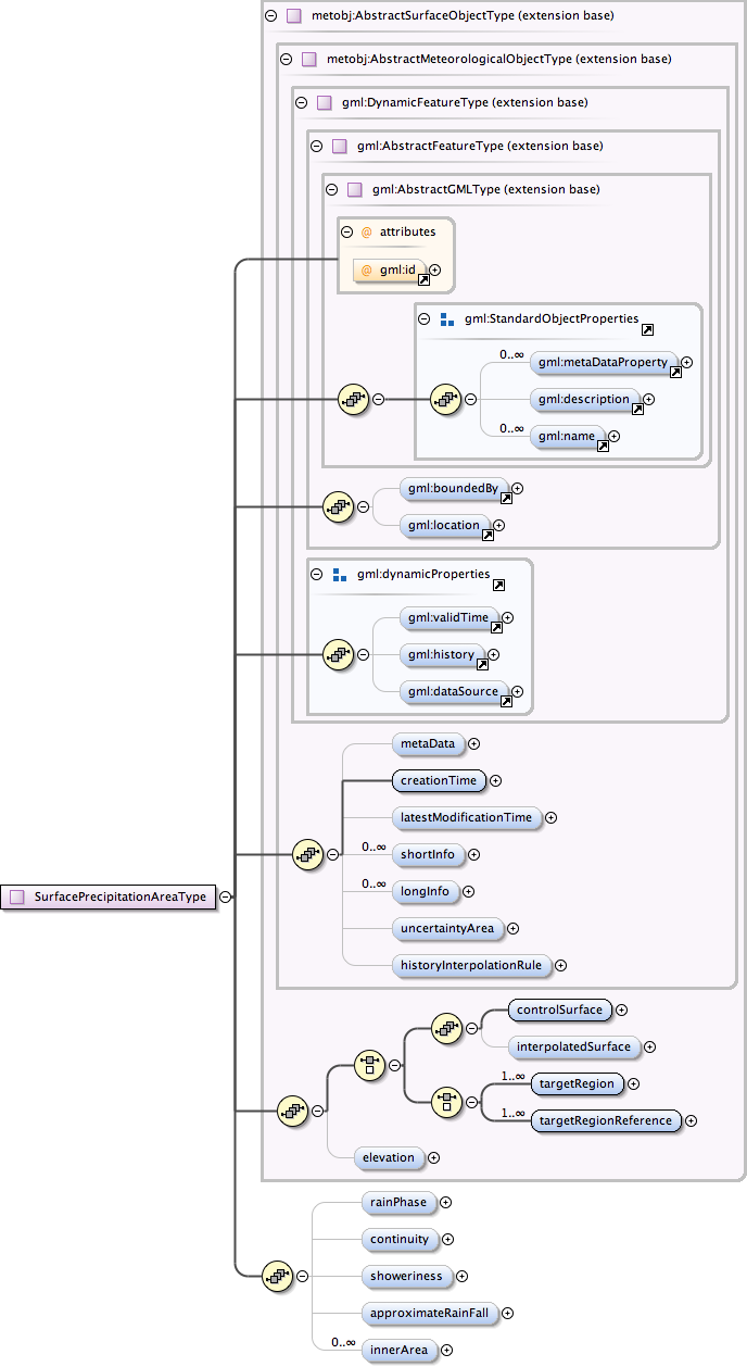
<html:div xmlns="http://www.w3.org/1999/xhtml"><p>Area of precipitation to be observed on the ground. Area is modelled as continuous patch of abstract earth surface (without topology) defined by an exterior Ring and 0..n interior Rings ("holes").</p><p>Exactly one rain (water) phase can be defined for the area.</p><p>The continuity (as in continuous rain) and the showeriness (as in rain showers) of the rain can both be specified as a floating point number between 0 and 1.</p><p>Precipitation areas may contain 0..n inner areas with different rain phase, continuity and/or showeriness qualities. These area are defined by using innerArea element which is a property containing or referring to another SurfacePrecipitationArea object. The exterior of the contained area object must be completely inside the exterior and not even partly cover the area inside any of the interior Rings of the parent object. If a value for any of the qualities is not given, it is assumed to be the same as in its parent.</p></html:div>
Database handle for the object. It is of XML type ID, so is constrained to be unique in the XML document within which it occurs. An external identifier for the object in the form of a URI may be constructed using standard XML and XPointer methods. This is done by concatenating the URI for the document, a fragment separator, and the value of the id attribute.
Source
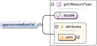
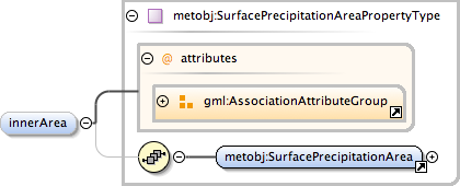
<complexType name="SurfacePrecipitationAreaType"><annotation><documentation><html:div xmlns="http://www.w3.org/1999/xhtml"><p>Area of precipitation to be observed on the ground. Area is modelled as continuous patch of abstract earth surface (without topology) defined by an exterior Ring and 0..n interior Rings ("holes").</p><p>Exactly one rain (water) phase can be defined for the area.</p><p>The continuity (as in continuous rain) and the showeriness (as in rain showers) of the rain can both be specified as a floating point number between 0 and 1.</p><p>Precipitation areas may contain 0..n inner areas with different rain phase, continuity and/or showeriness qualities. These area are defined by using innerArea element which is a property containing or referring to another SurfacePrecipitationArea object. The exterior of the contained area object must be completely inside the exterior and not even partly cover the area inside any of the interior Rings of the parent object. If a value for any of the qualities is not given, it is assumed to be the same as in its parent.</p></html:div></documentation></annotation><complexContent><extension base="metobj:AbstractSurfaceObjectType"><sequence><element name="rainPhase" type="metobj:rainPhaseType" minOccurs="0" maxOccurs="1"/><element name="continuity" type="metobj:percentageType" minOccurs="0" maxOccurs="1"/><element name="showeriness" type="metobj:percentageType" minOccurs="0" maxOccurs="1"/><element name="approximateRainFall" type="gml:MeasureType" minOccurs="0" maxOccurs="1"/><element name="innerArea" type="metobj:SurfacePrecipitationAreaPropertyType" minOccurs="0" maxOccurs="unbounded"/></sequence></extension></complexContent></complexType>