| Namespace | http://xml.fmi.fi/namespace/meteorology/conceptual-model/meteorological-objects/2009/11/09 | |||||||||||||
|
Annotations
|
|
|||||||||||||
|
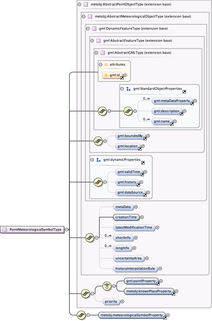
Diagram
|
 |
|||||||||||||
| Type | extension of metobj:AbstractPointObjectType | |||||||||||||
| Type hierarchy | ||||||||||||||
|
Used by
|
|
|||||||||||||
| Model | gml:metaDataProperty* , gml:description{0,1} , gml:name* , gml:boundedBy{0,1} , gml:location{0,1} , gml:validTime{0,1} , gml:history{0,1} , gml:dataSource{0,1} , metobj:metaData{0,1} , metobj:creationTime , metobj:latestModificationTime{0,1} , metobj:shortInfo* , metobj:longInfo* , metobj:uncertaintyArea{0,1} , metobj:historyInterpolationRule{0,1} , (gml:pointProperty | metobj:knownPlaceProperty) , metobj:priority{0,1} , metobj:meteorologicalSymbolProperty | |||||||||||||
| Children | gml:boundedBy, gml:dataSource, gml:description, gml:history, gml:location, gml:metaDataProperty, gml:name, gml:pointProperty, gml:validTime, metobj:creationTime, metobj:historyInterpolationRule, metobj:knownPlaceProperty, metobj:latestModificationTime, metobj:longInfo, metobj:metaData, metobj:meteorologicalSymbolProperty, metobj:priority, metobj:shortInfo, metobj:uncertaintyArea | |||||||||||||
|
Attributes
|
|
|||||||||||||
|
Source
|
|
|||||||||||||
| Schema location | http://xml.fmi.fi/schema/meteorology/conceptual-model/meteorological-objects/2009/11/09/metobjects-point.xsd |