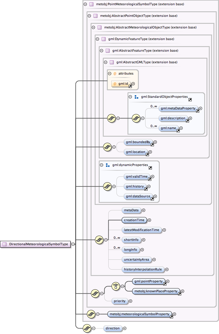
| Namespace | http://xml.fmi.fi/namespace/meteorology/conceptual-model/meteorological-objects/2009/11/09 | ||||||||||||||||||||||||||||||||||
|
Diagram
|
 |
||||||||||||||||||||||||||||||||||
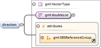
| Type | gml:VectorType | ||||||||||||||||||||||||||||||||||
| Type hierarchy |
|
||||||||||||||||||||||||||||||||||
|
Properties
|
|
||||||||||||||||||||||||||||||||||
|
Attributes
|
|
||||||||||||||||||||||||||||||||||
|
Source
|
|
||||||||||||||||||||||||||||||||||
| Schema location | http://xml.fmi.fi/schema/meteorology/conceptual-model/meteorological-objects/2009/11/09/metobjects-point.xsd |